Poison Creek Slough Topo Map Oregon
To zoom in, hover over the map of Poison Creek Slough
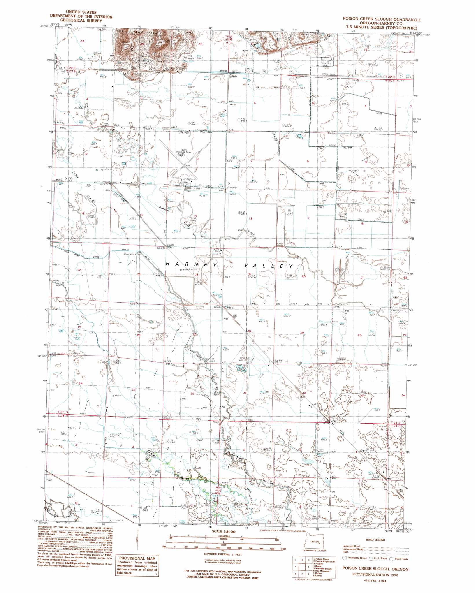
USGS Topo Quad 43118e8 - 1:24,000 scale
| Topo Map Name: | Poison Creek Slough |
| USGS Topo Quad ID: | 43118e8 |
| Print Size: | ca. 21 1/4" wide x 27" high |
| Southeast Coordinates: | 43.5° N latitude / 118.875° W longitude |
| Map Center Coordinates: | 43.5625° N latitude / 118.9375° W longitude |
| U.S. State: | OR |
| Filename: | o43118e8.jpg |
| Download Map JPG Image: | Poison Creek Slough topo map 1:24,000 scale |
| Map Type: | Topographic |
| Topo Series: | 7.5´ |
| Map Scale: | 1:24,000 |
| Source of Map Images: | United States Geological Survey (USGS) |
| Alternate Map Versions: |
Poison Creek Slough OR 1990, updated 1990 Download PDF Buy paper map Poison Creek Slough OR 2011 Download PDF Buy paper map Poison Creek Slough OR 2014 Download PDF Buy paper map |
1:24,000 Topo Quads surrounding Poison Creek Slough
Landing Creek |
Mosquito Flat |
Devine Ridge North |
Telephone Butte |
Craft Point |
Burns Ne |
Poison Creek |
Devine Ridge South |
Harney |
Buchanan |
Burns Butte |
Burns |
Poison Creek Slough |
Ninemile Slough |
Carson Point |
Weaver Lake |
Dog Mountain |
Redess |
Lawen |
Warm Springs Butte |
Northwest Harney Lake |
Northeast Harney Lake |
The Narrows |
Malheur Lake West |
Malheur Lake East |
> Back to 43118e1 at 1:100,000 scale
> Back to 43118a1 at 1:250,000 scale
> Back to U.S. Topo Maps home
Poison Creek Slough topo map: Gazetteer
Poison Creek Slough: Airports
Burns Municipal Airport elevation 1263m 4143′Poison Creek Slough: Canals
Upper Hanley Canal elevation 1262m 4140′Poison Creek Slough: Streams
Foley Slough elevation 1263m 4143′Poison Creek Slough elevation 1260m 4133′
Prater Creek elevation 1264m 4146′
Poison Creek Slough: Valleys
Byrd Canyon elevation 1266m 4153′Poison Creek Slough: Wells
Howes Well elevation 1260m 4133′Tiller Well elevation 1261m 4137′
Poison Creek Slough digital topo map on disk
Buy this Poison Creek Slough topo map showing relief, roads, GPS coordinates and other geographical features, as a high-resolution digital map file on DVD: