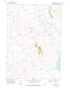
Upton Mountain Topo Map Oregon
To zoom in, hover over the map of Upton Mountain
USGS Topo Quad 43118f3 - 1:24,000 scale
| Topo Map Name: | Upton Mountain |
| USGS Topo Quad ID: | 43118f3 |
| Print Size: | ca. 21 1/4" wide x 27" high |
| Southeast Coordinates: | 43.625° N latitude / 118.25° W longitude |
| Map Center Coordinates: | 43.6875° N latitude / 118.3125° W longitude |
| U.S. State: | OR |
| Filename: | o43118f3.jpg |
| Download Map JPG Image: | Upton Mountain topo map 1:24,000 scale |
| Map Type: | Topographic |
| Topo Series: | 7.5´ |
| Map Scale: | 1:24,000 |
| Source of Map Images: | United States Geological Survey (USGS) |
| Alternate Map Versions: |
Upton Mountain OR 1973, updated 1977 Download PDF Buy paper map Upton Mountain OR 2011 Download PDF Buy paper map Upton Mountain OR 2014 Download PDF Buy paper map |
1:24,000 Topo Quads surrounding Upton Mountain
> Back to 43118e1 at 1:100,000 scale
> Back to 43118a1 at 1:250,000 scale
> Back to U.S. Topo Maps home
Upton Mountain topo map: Gazetteer
Upton Mountain: Flats
Shurtz Field elevation 1135m 3723′Upton Mountain: Gaps
Altnow Gap elevation 1344m 4409′Upton Pass elevation 1297m 4255′
Upton Mountain: Reservoirs
Altnow Gap Reservoir elevation 1353m 4438′Dirt Reservoir elevation 1154m 3786′
Drinkwater Reservoir Number Two elevation 1297m 4255′
Little Salt Reservoir elevation 1178m 3864′
Split Tree Reservoir elevation 1200m 3937′
Stray Dog Reservoir elevation 1198m 3930′
Upton Mountain Reservoir Number One elevation 1373m 4504′
Upton Mountain Reservoir Number Two elevation 1202m 3943′
Upton Mountain: Springs
Alkali Spring elevation 1100m 3608′Altnow Spring elevation 1078m 3536′
Bread Spring elevation 1073m 3520′
Buskirk Spring elevation 1124m 3687′
Carey Spring elevation 1067m 3500′
Company Spring elevation 1047m 3435′
Cottonwood Spring elevation 1203m 3946′
Riley Spring elevation 1181m 3874′
Summit Spring elevation 1153m 3782′
Upton Mountain: Streams
Cottonwood Creek elevation 1054m 3458′Upton Mountain: Summits
Carey Tables elevation 1294m 4245′Cat Rock elevation 1100m 3608′
Riley Butte elevation 1442m 4730′
Upton Mountain elevation 1455m 4773′
Upton Mountain digital topo map on disk
Buy this Upton Mountain topo map showing relief, roads, GPS coordinates and other geographical features, as a high-resolution digital map file on DVD:


