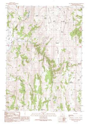
De Armond Mountain Topo Map Oregon
To zoom in, hover over the map of De Armond Mountain
USGS Topo Quad 43118h1 - 1:24,000 scale
| Topo Map Name: | De Armond Mountain |
| USGS Topo Quad ID: | 43118h1 |
| Print Size: | ca. 21 1/4" wide x 27" high |
| Southeast Coordinates: | 43.875° N latitude / 118° W longitude |
| Map Center Coordinates: | 43.9375° N latitude / 118.0625° W longitude |
| U.S. State: | OR |
| Filename: | o43118h1.jpg |
| Download Map JPG Image: | De Armond Mountain topo map 1:24,000 scale |
| Map Type: | Topographic |
| Topo Series: | 7.5´ |
| Map Scale: | 1:24,000 |
| Source of Map Images: | United States Geological Survey (USGS) |
| Alternate Map Versions: |
De Armond Mountain OR 1990, updated 1991 Download PDF Buy paper map De Armond Mountain OR 2011 Download PDF Buy paper map De Armond Mountain OR 2014 Download PDF Buy paper map |
1:24,000 Topo Quads surrounding De Armond Mountain
> Back to 43118e1 at 1:100,000 scale
> Back to 43118a1 at 1:250,000 scale
> Back to U.S. Topo Maps home
De Armond Mountain topo map: Gazetteer
De Armond Mountain: Dams
Murphy Dam elevation 1187m 3894′De Armond Mountain: Flats
Big Flat elevation 1611m 5285′Poverty Flat elevation 1242m 4074′
De Armond Mountain: Reservoirs
Angel Wells Reservoir elevation 1538m 5045′Becker Reservoir elevation 1576m 5170′
Burnt Mountain Reservoir elevation 1610m 5282′
Goldy Reservoir elevation 1432m 4698′
Juniper Reservoir elevation 1416m 4645′
Murphy Reservoir elevation 1434m 4704′
Rattlesnake Reservoir elevation 1534m 5032′
Table Reservoir elevation 1434m 4704′
Warm Springs Reservoir elevation 1540m 5052′
De Armond Mountain: Ridges
Bendire Ridge elevation 1647m 5403′De Armond Mountain: Springs
Baker Spring elevation 1532m 5026′Barrel Spring elevation 1577m 5173′
Indian Spring elevation 1539m 5049′
Juniper Spring elevation 1506m 4940′
Lower Morton Spring elevation 1443m 4734′
Morton Spring elevation 1479m 4852′
Munkers Spring elevation 1434m 4704′
Poverty Flat Spring elevation 1330m 4363′
Rattlesnake Spring elevation 1541m 5055′
Rodeo Spring elevation 1566m 5137′
De Armond Mountain: Streams
Bendire Creek elevation 1046m 3431′North Fork Warm Springs Creek elevation 1287m 4222′
De Armond Mountain: Summits
Bendire Mountain elevation 1461m 4793′De Armond Mountain elevation 1608m 5275′
De Armond Mountain: Valleys
Pole Gulch elevation 1065m 3494′Slaughter Gulch elevation 1263m 4143′
De Armond Mountain digital topo map on disk
Buy this De Armond Mountain topo map showing relief, roads, GPS coordinates and other geographical features, as a high-resolution digital map file on DVD:


