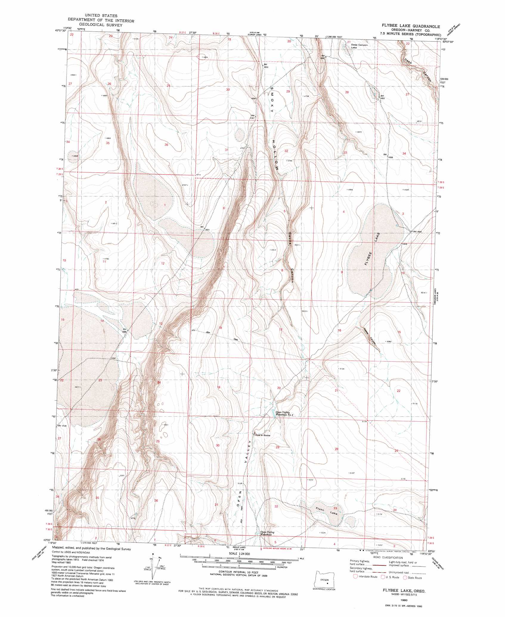
Flybee Lake Topo Map Oregon
To zoom in, hover over the map of Flybee Lake
USGS Topo Quad 43119a4 - 1:24,000 scale
| Topo Map Name: | Flybee Lake |
| USGS Topo Quad ID: | 43119a4 |
| Print Size: | ca. 21 1/4" wide x 27" high |
| Southeast Coordinates: | 43° N latitude / 119.375° W longitude |
| Map Center Coordinates: | 43.0625° N latitude / 119.4375° W longitude |
| U.S. State: | OR |
| Filename: | o43119a4.jpg |
| Download Map JPG Image: | Flybee Lake topo map 1:24,000 scale |
| Map Type: | Topographic |
| Topo Series: | 7.5´ |
| Map Scale: | 1:24,000 |
| Source of Map Images: | United States Geological Survey (USGS) |
| Alternate Map Versions: |
Flybee Lake OR 1980, updated 1980 Download PDF Buy paper map Flybee Lake OR 2011 Download PDF Buy paper map Flybee Lake OR 2014 Download PDF Buy paper map |
1:24,000 Topo Quads surrounding Flybee Lake
Alec Butte |
Lake On The Trail |
Iron Mountain Flat |
Stinking Lake |
Northwest Harney Lake |
Goose Egg Butte |
Wilson Butte |
Lunch Lake |
Hughet Spring |
Southwest Harney Lake |
Dry Valley Rim |
Rawhide Canyon |
Flybee Lake |
Meadow Lake |
Weed Lake Butte |
Red Bank Lakes |
Rock Camp Draw |
Balls Lake |
Clover Swale |
Keg Sprs Valley West |
Corporation Rim |
Steamboat Point |
Orejana Canyon |
Duhaime Flat West |
Duhaime Flat East |
> Back to 43119a1 at 1:100,000 scale
> Back to 43118a1 at 1:250,000 scale
> Back to U.S. Topo Maps home
Flybee Lake topo map: Gazetteer
Flybee Lake: Flats
Deep Canyon Lake elevation 1492m 4895′Flybee Lake elevation 1507m 4944′
Flynn Lake elevation 1575m 5167′
Flybee Lake: Lakes
Open Valley Waterhole Number Three elevation 1552m 5091′Flybee Lake: Springs
Hole in Rocks elevation 1557m 5108′Open Valley Waterhole elevation 1564m 5131′
Flybee Lake: Valleys
Devils Canyon elevation 1451m 4760′Little Valley elevation 1432m 4698′
Open Valley elevation 1524m 5000′
Flybee Lake digital topo map on disk
Buy this Flybee Lake topo map showing relief, roads, GPS coordinates and other geographical features, as a high-resolution digital map file on DVD: