Rawhide Canyon Topo Map Oregon
To zoom in, hover over the map of Rawhide Canyon
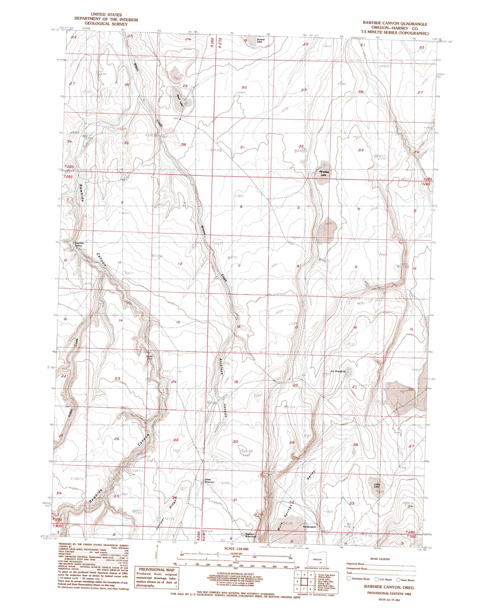
USGS Topo Quad 43119a5 - 1:24,000 scale
| Topo Map Name: | Rawhide Canyon |
| USGS Topo Quad ID: | 43119a5 |
| Print Size: | ca. 21 1/4" wide x 27" high |
| Southeast Coordinates: | 43° N latitude / 119.5° W longitude |
| Map Center Coordinates: | 43.0625° N latitude / 119.5625° W longitude |
| U.S. State: | OR |
| Filename: | o43119a5.jpg |
| Download Map JPG Image: | Rawhide Canyon topo map 1:24,000 scale |
| Map Type: | Topographic |
| Topo Series: | 7.5´ |
| Map Scale: | 1:24,000 |
| Source of Map Images: | United States Geological Survey (USGS) |
| Alternate Map Versions: |
Rawhide Canyon OR 1984, updated 1984 Download PDF Buy paper map Rawhide Canyon OR 2011 Download PDF Buy paper map Rawhide Canyon OR 2014 Download PDF Buy paper map |
1:24,000 Topo Quads surrounding Rawhide Canyon
Wagontire Mountain East |
Alec Butte |
Lake On The Trail |
Iron Mountain Flat |
Stinking Lake |
Little Juniper Mountain |
Goose Egg Butte |
Wilson Butte |
Lunch Lake |
Hughet Spring |
Cox Canyon |
Dry Valley Rim |
Rawhide Canyon |
Flybee Lake |
Meadow Lake |
Turpin Knoll |
Red Bank Lakes |
Rock Camp Draw |
Balls Lake |
Clover Swale |
Corn Lake |
Corporation Rim |
Steamboat Point |
Orejana Canyon |
Duhaime Flat West |
> Back to 43119a1 at 1:100,000 scale
> Back to 43118a1 at 1:250,000 scale
> Back to U.S. Topo Maps home
Rawhide Canyon topo map: Gazetteer
Rawhide Canyon: Lakes
Boyce Waterhole elevation 1525m 5003′Rawhide Canyon: Reservoirs
North Wilson Reservoir elevation 1487m 4878′Rawhide Canyon: Valleys
Rawhide Canyon elevation 1525m 5003′Rawhide Canyon digital topo map on disk
Buy this Rawhide Canyon topo map showing relief, roads, GPS coordinates and other geographical features, as a high-resolution digital map file on DVD: