Northeast Harney Lake Topo Map Oregon
To zoom in, hover over the map of Northeast Harney Lake
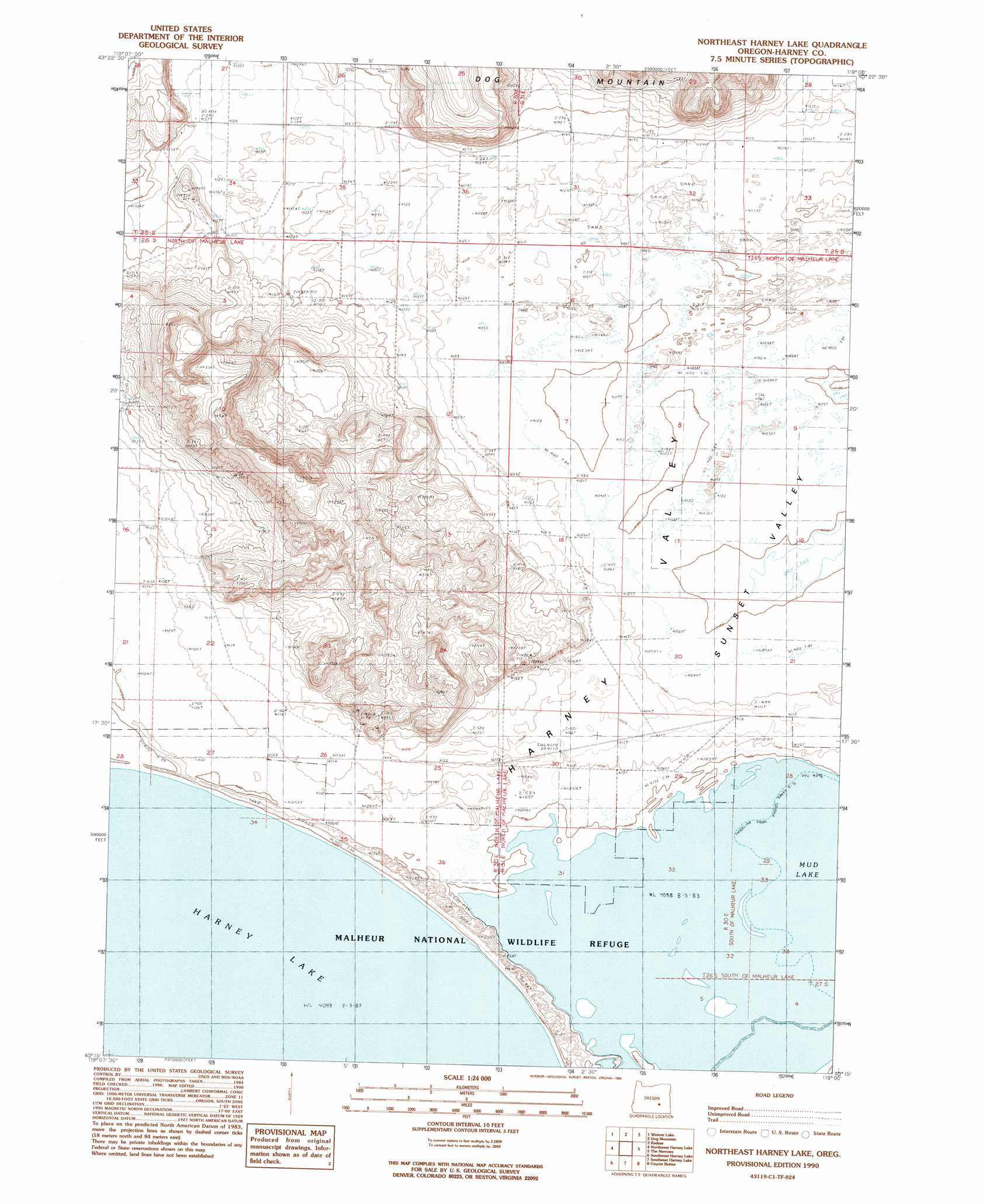
USGS Topo Quad 43119c1 - 1:24,000 scale
| Topo Map Name: | Northeast Harney Lake |
| USGS Topo Quad ID: | 43119c1 |
| Print Size: | ca. 21 1/4" wide x 27" high |
| Southeast Coordinates: | 43.25° N latitude / 119° W longitude |
| Map Center Coordinates: | 43.3125° N latitude / 119.0625° W longitude |
| U.S. State: | OR |
| Filename: | o43119c1.jpg |
| Download Map JPG Image: | Northeast Harney Lake topo map 1:24,000 scale |
| Map Type: | Topographic |
| Topo Series: | 7.5´ |
| Map Scale: | 1:24,000 |
| Source of Map Images: | United States Geological Survey (USGS) |
| Alternate Map Versions: |
Northeast Harney Lake OR 1990, updated 1990 Download PDF Buy paper map Northeast Harney Lake OR 2011 Download PDF Buy paper map Northeast Harney Lake OR 2014 Download PDF Buy paper map |
1:24,000 Topo Quads surrounding Northeast Harney Lake
Sage Hen Hill |
Burns Butte |
Burns |
Poison Creek Slough |
Ninemile Slough |
Palomino Buttes |
Weaver Lake |
Dog Mountain |
Redess |
Lawen |
Stinking Lake |
Northwest Harney Lake |
Northeast Harney Lake |
The Narrows |
Malheur Lake West |
Hughet Spring |
Southwest Harney Lake |
Southeast Harney Lake |
Coyote Buttes |
Jackass Butte Ne |
Meadow Lake |
Weed Lake Butte |
Twin Buttes |
Jackass Butte |
Diamond Swamp |
> Back to 43119a1 at 1:100,000 scale
> Back to 43118a1 at 1:250,000 scale
> Back to U.S. Topo Maps home
Northeast Harney Lake topo map: Gazetteer
Northeast Harney Lake: Post Offices
Loma Post Office (historical) elevation 1254m 4114′Northeast Harney Lake digital topo map on disk
Buy this Northeast Harney Lake topo map showing relief, roads, GPS coordinates and other geographical features, as a high-resolution digital map file on DVD: