Northwest Harney Lake Topo Map Oregon
To zoom in, hover over the map of Northwest Harney Lake
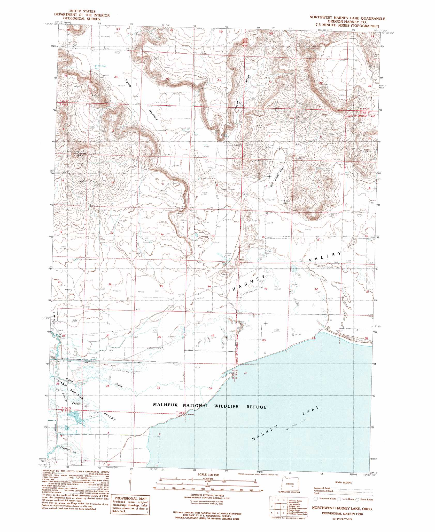
USGS Topo Quad 43119c2 - 1:24,000 scale
| Topo Map Name: | Northwest Harney Lake |
| USGS Topo Quad ID: | 43119c2 |
| Print Size: | ca. 21 1/4" wide x 27" high |
| Southeast Coordinates: | 43.25° N latitude / 119.125° W longitude |
| Map Center Coordinates: | 43.3125° N latitude / 119.1875° W longitude |
| U.S. State: | OR |
| Filename: | o43119c2.jpg |
| Download Map JPG Image: | Northwest Harney Lake topo map 1:24,000 scale |
| Map Type: | Topographic |
| Topo Series: | 7.5´ |
| Map Scale: | 1:24,000 |
| Source of Map Images: | United States Geological Survey (USGS) |
| Alternate Map Versions: |
Northwest Harney Lake OR 1990, updated 1990 Download PDF Buy paper map Northwest Harney Lake OR 2011 Download PDF Buy paper map Northwest Harney Lake OR 2014 Download PDF Buy paper map |
1:24,000 Topo Quads surrounding Northwest Harney Lake
Oakerman Lakes |
Sage Hen Hill |
Burns Butte |
Burns |
Poison Creek Slough |
Moon Reservoir |
Palomino Buttes |
Weaver Lake |
Dog Mountain |
Redess |
Iron Mountain Flat |
Stinking Lake |
Northwest Harney Lake |
Northeast Harney Lake |
The Narrows |
Lunch Lake |
Hughet Spring |
Southwest Harney Lake |
Southeast Harney Lake |
Coyote Buttes |
Flybee Lake |
Meadow Lake |
Weed Lake Butte |
Twin Buttes |
Jackass Butte |
> Back to 43119a1 at 1:100,000 scale
> Back to 43118a1 at 1:250,000 scale
> Back to U.S. Topo Maps home
Northwest Harney Lake topo map: Gazetteer
Northwest Harney Lake: Airports
Reed Landing Strip elevation 1262m 4140′Northwest Harney Lake: Canals
Goulden Canal elevation 1252m 4107′Saint Clair Canal elevation 1252m 4107′
Northwest Harney Lake: Streams
Silver Creek elevation 1250m 4101′South Warm Springs Creek elevation 1252m 4107′
Warm Springs Creek elevation 1250m 4101′
Northwest Harney Lake: Summits
Freeman Butte elevation 1379m 4524′Northwest Harney Lake: Valleys
Brown Canyon elevation 1261m 4137′Sand Hollow elevation 1251m 4104′
Northwest Harney Lake: Wells
Hughet Well elevation 1258m 4127′Northwest Harney Lake digital topo map on disk
Buy this Northwest Harney Lake topo map showing relief, roads, GPS coordinates and other geographical features, as a high-resolution digital map file on DVD: