Lake On The Trail Topo Map Oregon
To zoom in, hover over the map of Lake On The Trail
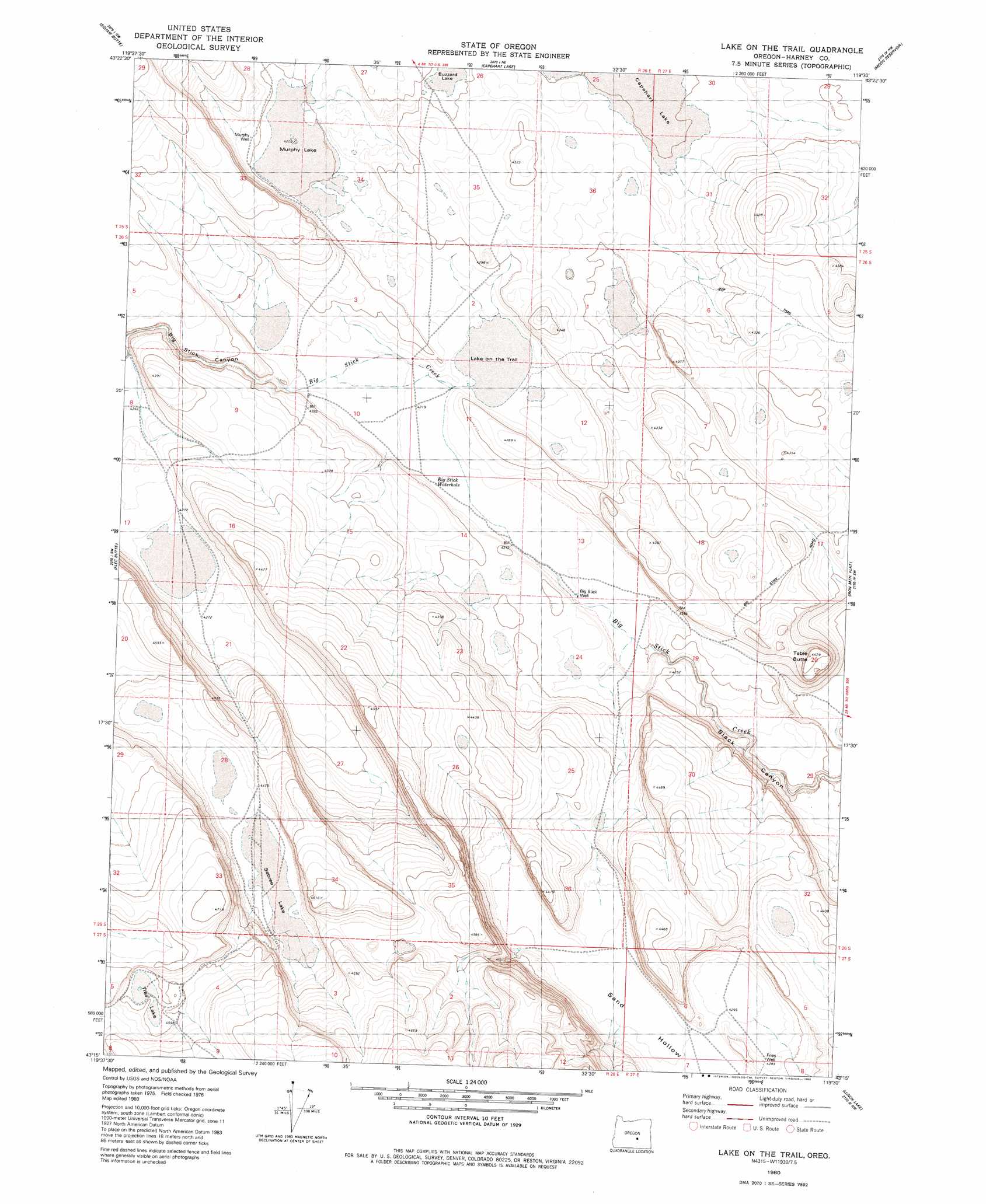
USGS Topo Quad 43119c5 - 1:24,000 scale
| Topo Map Name: | Lake On The Trail |
| USGS Topo Quad ID: | 43119c5 |
| Print Size: | ca. 21 1/4" wide x 27" high |
| Southeast Coordinates: | 43.25° N latitude / 119.5° W longitude |
| Map Center Coordinates: | 43.3125° N latitude / 119.5625° W longitude |
| U.S. State: | OR |
| Filename: | o43119c5.jpg |
| Download Map JPG Image: | Lake On The Trail topo map 1:24,000 scale |
| Map Type: | Topographic |
| Topo Series: | 7.5´ |
| Map Scale: | 1:24,000 |
| Source of Map Images: | United States Geological Survey (USGS) |
| Alternate Map Versions: |
Lake on The Trail OR 1980, updated 1980 Download PDF Buy paper map Lake on the Trail OR 2011 Download PDF Buy paper map Lake on the Trail OR 2014 Download PDF Buy paper map |
1:24,000 Topo Quads surrounding Lake On The Trail
Potato Hills |
Suntex |
Riley |
Oakerman Lakes |
Sage Hen Hill |
Hay Lake |
Squaw Butte |
Capehart Lake |
Moon Reservoir |
Palomino Buttes |
Wagontire Mountain East |
Alec Butte |
Lake On The Trail |
Iron Mountain Flat |
Stinking Lake |
Little Juniper Mountain |
Goose Egg Butte |
Wilson Butte |
Lunch Lake |
Hughet Spring |
Cox Canyon |
Dry Valley Rim |
Rawhide Canyon |
Flybee Lake |
Meadow Lake |
> Back to 43119a1 at 1:100,000 scale
> Back to 43118a1 at 1:250,000 scale
> Back to U.S. Topo Maps home
Lake On The Trail topo map: Gazetteer
Lake On The Trail: Streams
Wilson Creek elevation 1287m 4222′Lake On The Trail: Valleys
Black Canyon elevation 1262m 4140′Lake On The Trail digital topo map on disk
Buy this Lake On The Trail topo map showing relief, roads, GPS coordinates and other geographical features, as a high-resolution digital map file on DVD: