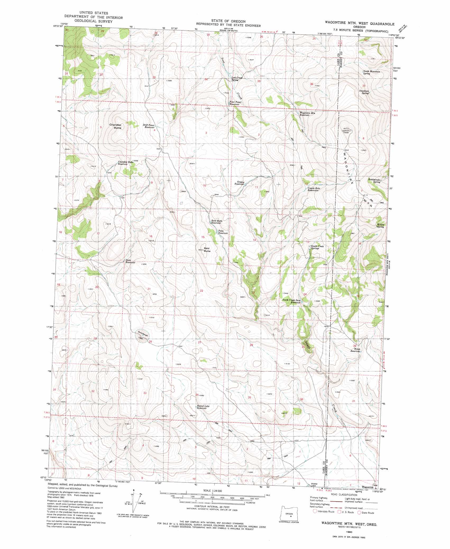
Wagontire Mountain West Topo Map Oregon
To zoom in, hover over the map of Wagontire Mountain West
USGS Topo Quad 43119c8 - 1:24,000 scale
| Topo Map Name: | Wagontire Mountain West |
| USGS Topo Quad ID: | 43119c8 |
| Print Size: | ca. 21 1/4" wide x 27" high |
| Southeast Coordinates: | 43.25° N latitude / 119.875° W longitude |
| Map Center Coordinates: | 43.3125° N latitude / 119.9375° W longitude |
| U.S. State: | OR |
| Filename: | o43119c8.jpg |
| Download Map JPG Image: | Wagontire Mountain West topo map 1:24,000 scale |
| Map Type: | Topographic |
| Topo Series: | 7.5´ |
| Map Scale: | 1:24,000 |
| Source of Map Images: | United States Geological Survey (USGS) |
| Alternate Map Versions: |
Wagontire Mtn West OR 1980, updated 1980 Download PDF Buy paper map Wagontire Mountain West OR 2011 Download PDF Buy paper map Wagontire Mountain West OR 2014 Download PDF Buy paper map |
1:24,000 Topo Quads surrounding Wagontire Mountain West
Potato Lake |
Glass Butte |
Hat Butte |
Potato Hills |
Suntex |
Chicago Valley |
Tired Horse Butte |
Round Top Butte |
Hay Lake |
Squaw Butte |
Elk Butte |
Rams Butte |
Wagontire Mountain West |
Wagontire Mountain East |
Alec Butte |
Horse Mountain |
Goodrich Well |
Locust Butte |
Little Juniper Mountain |
Goose Egg Butte |
Poverty Basin North |
Alkali Buttes |
Venator Canyon |
Cox Canyon |
Dry Valley Rim |
> Back to 43119a1 at 1:100,000 scale
> Back to 43118a1 at 1:250,000 scale
> Back to U.S. Topo Maps home
Wagontire Mountain West topo map: Gazetteer
Wagontire Mountain West: Reservoirs
Lost Creek Reservoir elevation 1585m 5200′Wagontire Mountain West: Summits
Wagontire Mountain elevation 1963m 6440′Wagontire Mountain West digital topo map on disk
Buy this Wagontire Mountain West topo map showing relief, roads, GPS coordinates and other geographical features, as a high-resolution digital map file on DVD: