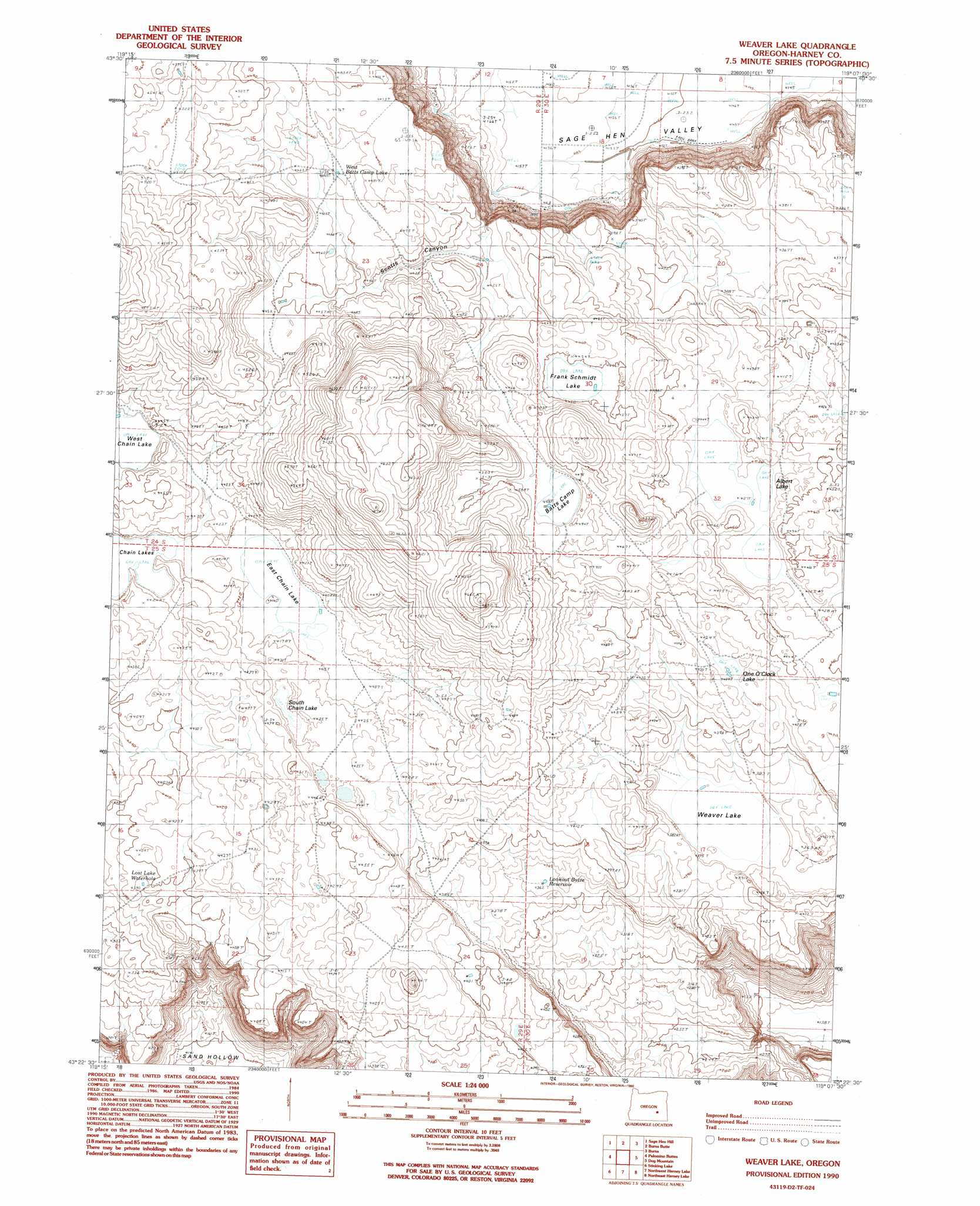
Weaver Lake Topo Map Oregon
To zoom in, hover over the map of Weaver Lake
USGS Topo Quad 43119d2 - 1:24,000 scale
| Topo Map Name: | Weaver Lake |
| USGS Topo Quad ID: | 43119d2 |
| Print Size: | ca. 21 1/4" wide x 27" high |
| Southeast Coordinates: | 43.375° N latitude / 119.125° W longitude |
| Map Center Coordinates: | 43.4375° N latitude / 119.1875° W longitude |
| U.S. State: | OR |
| Filename: | o43119d2.jpg |
| Download Map JPG Image: | Weaver Lake topo map 1:24,000 scale |
| Map Type: | Topographic |
| Topo Series: | 7.5´ |
| Map Scale: | 1:24,000 |
| Source of Map Images: | United States Geological Survey (USGS) |
| Alternate Map Versions: |
Weaver Lake OR 1990, updated 1990 Download PDF Buy paper map Weaver Lake OR 2011 Download PDF Buy paper map Weaver Lake OR 2014 Download PDF Buy paper map |
1:24,000 Topo Quads surrounding Weaver Lake
Egypt Canyon |
Holmes Canyon |
Burns Ne |
Poison Creek |
Devine Ridge South |
Oakerman Lakes |
Sage Hen Hill |
Burns Butte |
Burns |
Poison Creek Slough |
Moon Reservoir |
Palomino Buttes |
Weaver Lake |
Dog Mountain |
Redess |
Iron Mountain Flat |
Stinking Lake |
Northwest Harney Lake |
Northeast Harney Lake |
The Narrows |
Lunch Lake |
Hughet Spring |
Southwest Harney Lake |
Southeast Harney Lake |
Coyote Buttes |
> Back to 43119a1 at 1:100,000 scale
> Back to 43118a1 at 1:250,000 scale
> Back to U.S. Topo Maps home
Weaver Lake topo map: Gazetteer
Weaver Lake: Basins
Sage Hen Valley elevation 1266m 4153′Weaver Lake: Lakes
Albert Lake elevation 1354m 4442′Batts Camp Lake elevation 1366m 4481′
East Chain Lake elevation 1345m 4412′
Frank Schmidt Lake elevation 1356m 4448′
South Chain Lake elevation 1346m 4416′
Weaver Lake elevation 1333m 4373′
Weaver Lake: Reservoirs
Cheatgrass Reservoir elevation 1366m 4481′Lookout Butte Reservoir elevation 1330m 4363′
Lost Lake Waterhole elevation 1339m 4393′
One O'Clock Lake elevation 1353m 4438′
West Batts Camp Lake elevation 1360m 4461′
Weaver Lake: Valleys
Scotts Canyon elevation 1349m 4425′Weaver Lake digital topo map on disk
Buy this Weaver Lake topo map showing relief, roads, GPS coordinates and other geographical features, as a high-resolution digital map file on DVD: