Burns Topo Map Oregon
To zoom in, hover over the map of Burns
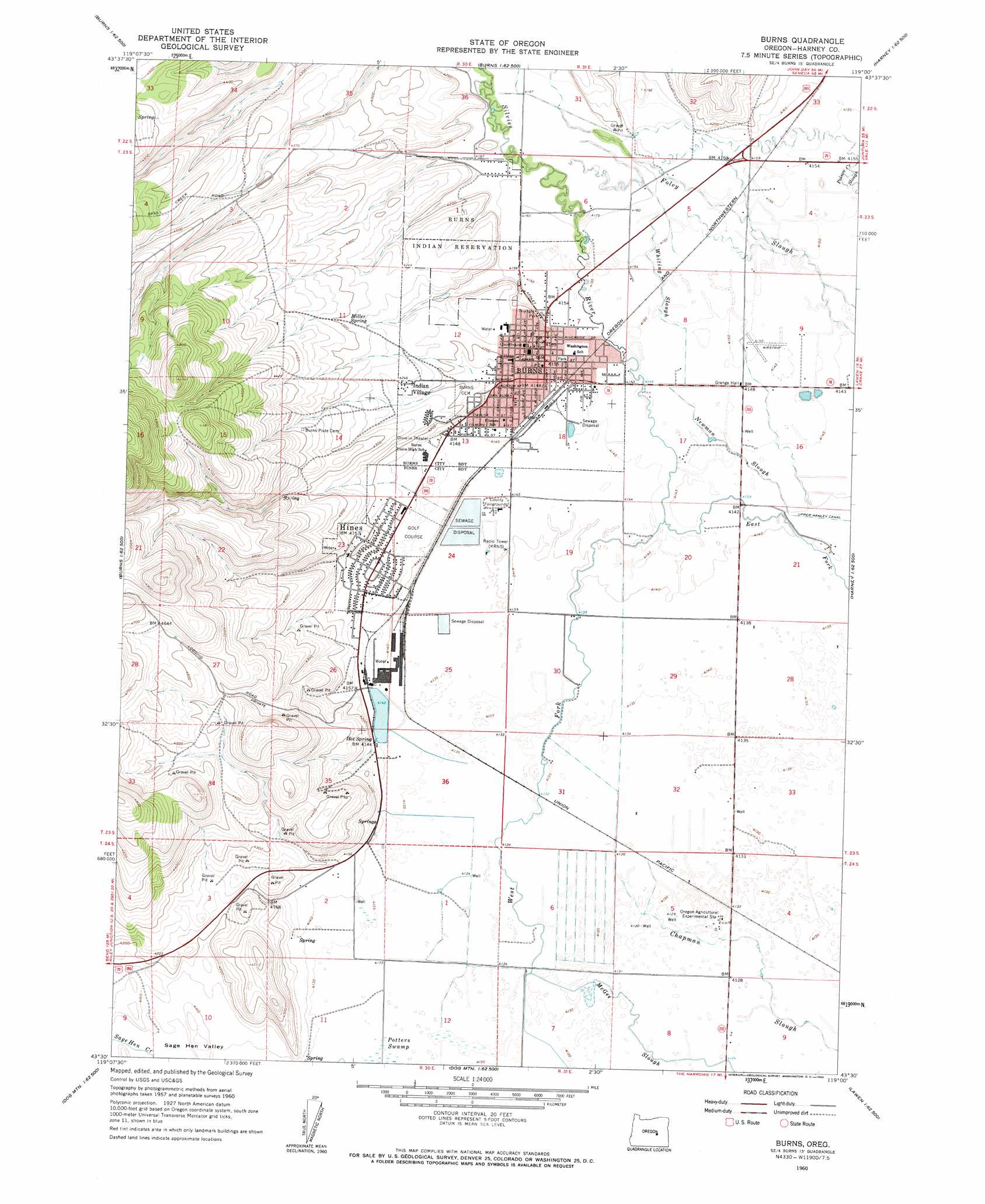
USGS Topo Quad 43119e1 - 1:24,000 scale
| Topo Map Name: | Burns |
| USGS Topo Quad ID: | 43119e1 |
| Print Size: | ca. 21 1/4" wide x 27" high |
| Southeast Coordinates: | 43.5° N latitude / 119° W longitude |
| Map Center Coordinates: | 43.5625° N latitude / 119.0625° W longitude |
| U.S. State: | OR |
| Filename: | o43119e1.jpg |
| Download Map JPG Image: | Burns topo map 1:24,000 scale |
| Map Type: | Topographic |
| Topo Series: | 7.5´ |
| Map Scale: | 1:24,000 |
| Source of Map Images: | United States Geological Survey (USGS) |
| Alternate Map Versions: |
Burns OR 1960, updated 1962 Download PDF Buy paper map Burns OR 1960, updated 1962 Download PDF Buy paper map Burns OR 1975, updated 1977 Download PDF Buy paper map Burns OR 2011 Download PDF Buy paper map Burns OR 2014 Download PDF Buy paper map |
1:24,000 Topo Quads surrounding Burns
Hughet Valley |
Landing Creek |
Mosquito Flat |
Devine Ridge North |
Telephone Butte |
Holmes Canyon |
Burns Ne |
Poison Creek |
Devine Ridge South |
Harney |
Sage Hen Hill |
Burns Butte |
Burns |
Poison Creek Slough |
Ninemile Slough |
Palomino Buttes |
Weaver Lake |
Dog Mountain |
Redess |
Lawen |
Stinking Lake |
Northwest Harney Lake |
Northeast Harney Lake |
The Narrows |
Malheur Lake West |
> Back to 43119e1 at 1:100,000 scale
> Back to 43118a1 at 1:250,000 scale
> Back to U.S. Topo Maps home
Burns topo map: Gazetteer
Burns: Airports
Davis Airstrip elevation 1265m 4150′Hines Airstrip elevation 1264m 4146′
Burns: Basins
Harney Basin elevation 1259m 4130′Burns: Dams
Paiute Dam elevation 1270m 4166′Sweek Dam elevation 1268m 4160′
Burns: Parks
Hines City Park elevation 1271m 4169′Triangle City Park elevation 1268m 4160′
Washington City Park elevation 1267m 4156′
Burns: Populated Places
Burns elevation 1266m 4153′Hines elevation 1268m 4160′
Indian Village elevation 1294m 4245′
Burns: Post Offices
Burns Post Office elevation 1266m 4153′Hines Post Office elevation 1268m 4160′
Burns: Reservoirs
Carter Reservoir elevation 1408m 4619′Hines Mill Pond elevation 1265m 4150′
Paiute Reservoir elevation 1272m 4173′
Burns: Springs
Hot Spring elevation 1265m 4150′Luig Spring elevation 1264m 4146′
Miller Spring elevation 1300m 4265′
Millpond Hot Spring elevation 1265m 4150′
Roadland Warm Springs elevation 1263m 4143′
Burns: Streams
Newman Slough elevation 1262m 4140′Poison Creek elevation 1268m 4160′
Silvies River elevation 1265m 4150′
Whiting Slough elevation 1265m 4150′
Burns: Swamps
Potters Swamp elevation 1261m 4137′Burns: Valleys
Heifer Canyon elevation 1264m 4146′Burns: Wells
Burns City Wells elevation 1293m 4242′Clemens Well elevation 1265m 4150′
Hotchkiss Well elevation 1265m 4150′
Burns digital topo map on disk
Buy this Burns topo map showing relief, roads, GPS coordinates and other geographical features, as a high-resolution digital map file on DVD: