Riley Topo Map Oregon
To zoom in, hover over the map of Riley
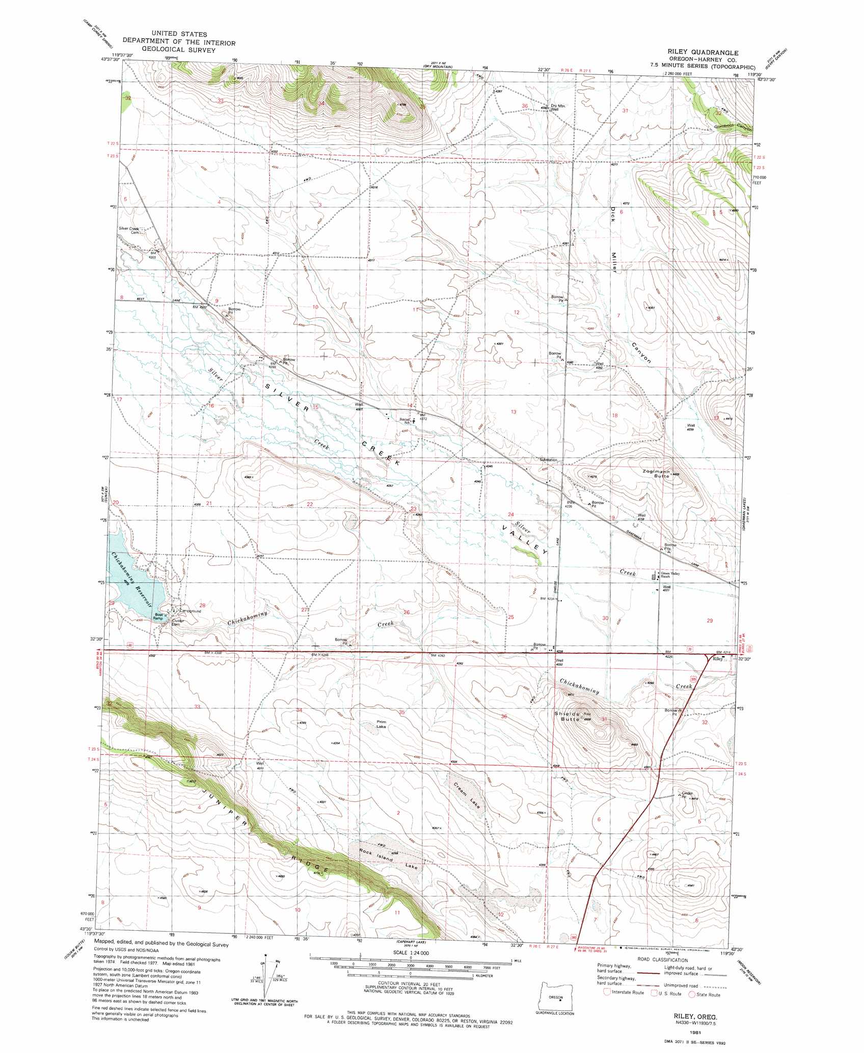
USGS Topo Quad 43119e5 - 1:24,000 scale
| Topo Map Name: | Riley |
| USGS Topo Quad ID: | 43119e5 |
| Print Size: | ca. 21 1/4" wide x 27" high |
| Southeast Coordinates: | 43.5° N latitude / 119.5° W longitude |
| Map Center Coordinates: | 43.5625° N latitude / 119.5625° W longitude |
| U.S. State: | OR |
| Filename: | o43119e5.jpg |
| Download Map JPG Image: | Riley topo map 1:24,000 scale |
| Map Type: | Topographic |
| Topo Series: | 7.5´ |
| Map Scale: | 1:24,000 |
| Source of Map Images: | United States Geological Survey (USGS) |
| Alternate Map Versions: |
Riley OR 1981, updated 1982 Download PDF Buy paper map Riley OR 2011 Download PDF Buy paper map Riley OR 2014 Download PDF Buy paper map |
1:24,000 Topo Quads surrounding Riley
Mackey Butte |
Buck Spring |
Donnelly Butte |
Bear Canyon Butte |
Hughet Valley |
Bulger Ridge |
Camp Currey Spring |
Dry Mountain |
Egypt Canyon |
Holmes Canyon |
Potato Hills |
Suntex |
Riley |
Oakerman Lakes |
Sage Hen Hill |
Hay Lake |
Squaw Butte |
Capehart Lake |
Moon Reservoir |
Palomino Buttes |
Wagontire Mountain East |
Alec Butte |
Lake On The Trail |
Iron Mountain Flat |
Stinking Lake |
> Back to 43119e1 at 1:100,000 scale
> Back to 43118a1 at 1:250,000 scale
> Back to U.S. Topo Maps home
Riley topo map: Gazetteer
Riley: Dams
Chickahominy Creek Dam elevation 1308m 4291′Riley: Lakes
Cream Lake elevation 1302m 4271′Riley: Populated Places
Riley elevation 1288m 4225′Riley: Post Offices
Riley Post Office elevation 1288m 4225′Riley: Reservoirs
Chickahominy Reservoir elevation 1308m 4291′Riley: Ridges
Juniper Ridge elevation 1470m 4822′Riley: Streams
Chickahominy Creek elevation 1290m 4232′Riley: Summits
Shields Butte elevation 1401m 4596′Riley: Valleys
Gum Boot Canyon elevation 1313m 4307′Gumboot Canyon elevation 1316m 4317′
Riley digital topo map on disk
Buy this Riley topo map showing relief, roads, GPS coordinates and other geographical features, as a high-resolution digital map file on DVD: