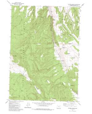
Holmes Canyon Topo Map Oregon
To zoom in, hover over the map of Holmes Canyon
USGS Topo Quad 43119f3 - 1:24,000 scale
| Topo Map Name: | Holmes Canyon |
| USGS Topo Quad ID: | 43119f3 |
| Print Size: | ca. 21 1/4" wide x 27" high |
| Southeast Coordinates: | 43.625° N latitude / 119.25° W longitude |
| Map Center Coordinates: | 43.6875° N latitude / 119.3125° W longitude |
| U.S. State: | OR |
| Filename: | o43119f3.jpg |
| Download Map JPG Image: | Holmes Canyon topo map 1:24,000 scale |
| Map Type: | Topographic |
| Topo Series: | 7.5´ |
| Map Scale: | 1:24,000 |
| Source of Map Images: | United States Geological Survey (USGS) |
| Alternate Map Versions: |
Holmes Canyon OR 1981, updated 1982 Download PDF Buy paper map Holmes Canyon OR 1992, updated 1997 Download PDF Buy paper map Holmes Canyon OR 2011 Download PDF Buy paper map Holmes Canyon OR 2014 Download PDF Buy paper map |
| FStopo: | US Forest Service topo Holmes Canyon is available: Download FStopo PDF Download FStopo TIF |
1:24,000 Topo Quads surrounding Holmes Canyon
> Back to 43119e1 at 1:100,000 scale
> Back to 43118a1 at 1:250,000 scale
> Back to U.S. Topo Maps home
Holmes Canyon topo map: Gazetteer
Holmes Canyon: Basins
Pine Spring Basin elevation 1528m 5013′Holmes Canyon: Dams
Rock Creek Dam elevation 1525m 5003′Holmes Canyon: Reservoirs
Dead End Reservoir elevation 1545m 5068′Deer Camp Reservoir elevation 1562m 5124′
Dry Gulch Reservoir elevation 1469m 4819′
East Horton Basin Reservoir elevation 1567m 5141′
Four Deer Reservoir elevation 1511m 4957′
Horse Spring Reservoir elevation 1580m 5183′
Horton Mill Reservoir elevation 1473m 4832′
Panel Spring Reservoir elevation 1575m 5167′
Rocky Road Reservoir elevation 1579m 5180′
Silver Reservoir elevation 1576m 5170′
Skull Creek Reservoir elevation 1503m 4931′
West Bassout Reservoir elevation 1523m 4996′
Holmes Canyon: Springs
Boulder Spring elevation 1531m 5022′Horse Spring elevation 1500m 4921′
Lumsden Spring elevation 1445m 4740′
Sagadore Spring elevation 1560m 5118′
Holmes Canyon: Summits
Bald Butte elevation 1734m 5688′Holmes Canyon: Valleys
Holmes Canyon elevation 1380m 4527′Horton Canyon elevation 1501m 4924′
Winslow Canyon elevation 1484m 4868′
Holmes Canyon digital topo map on disk
Buy this Holmes Canyon topo map showing relief, roads, GPS coordinates and other geographical features, as a high-resolution digital map file on DVD:


