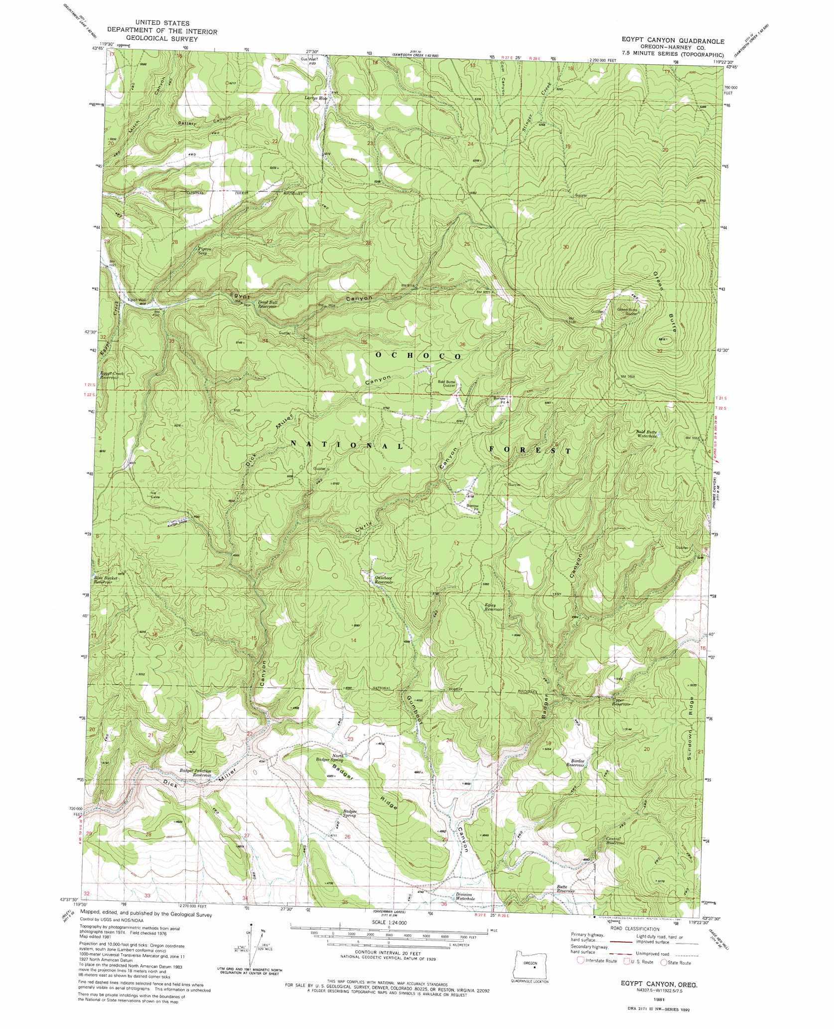
Egypt Canyon Topo Map Oregon
To zoom in, hover over the map of Egypt Canyon
USGS Topo Quad 43119f4 - 1:24,000 scale
| Topo Map Name: | Egypt Canyon |
| USGS Topo Quad ID: | 43119f4 |
| Print Size: | ca. 21 1/4" wide x 27" high |
| Southeast Coordinates: | 43.625° N latitude / 119.375° W longitude |
| Map Center Coordinates: | 43.6875° N latitude / 119.4375° W longitude |
| U.S. State: | OR |
| Filename: | o43119f4.jpg |
| Download Map JPG Image: | Egypt Canyon topo map 1:24,000 scale |
| Map Type: | Topographic |
| Topo Series: | 7.5´ |
| Map Scale: | 1:24,000 |
| Source of Map Images: | United States Geological Survey (USGS) |
| Alternate Map Versions: |
Egypt Canyon OR 1981, updated 1981 Download PDF Buy paper map Egypt Canyon OR 1992, updated 1997 Download PDF Buy paper map Egypt Canyon OR 2011 Download PDF Buy paper map Egypt Canyon OR 2014 Download PDF Buy paper map |
| FStopo: | US Forest Service topo Egypt Canyon is available: Download FStopo PDF Download FStopo TIF |
1:24,000 Topo Quads surrounding Egypt Canyon
Delintment Lake |
Big Mowich Mountain |
Whiskey Mountain |
Alsup Mountain |
West Myrtle Butte |
Buck Spring |
Donnelly Butte |
Bear Canyon Butte |
Hughet Valley |
Landing Creek |
Camp Currey Spring |
Dry Mountain |
Egypt Canyon |
Holmes Canyon |
Burns Ne |
Suntex |
Riley |
Oakerman Lakes |
Sage Hen Hill |
Burns Butte |
Squaw Butte |
Capehart Lake |
Moon Reservoir |
Palomino Buttes |
Weaver Lake |
> Back to 43119e1 at 1:100,000 scale
> Back to 43118a1 at 1:250,000 scale
> Back to U.S. Topo Maps home
Egypt Canyon topo map: Gazetteer
Egypt Canyon: Reservoirs
Kings Hole Reservoir elevation 1530m 5019′Egypt Canyon: Springs
Lost Spring elevation 1609m 5278′Egypt Canyon: Summits
Green Butte elevation 1793m 5882′Egypt Canyon: Valleys
Egypt Canyon elevation 1495m 4904′Egypt Canyon: Wells
Egypt Well elevation 1481m 4858′Gus Well elevation 1564m 5131′
Egypt Canyon digital topo map on disk
Buy this Egypt Canyon topo map showing relief, roads, GPS coordinates and other geographical features, as a high-resolution digital map file on DVD: