Dust Bowl Topo Map Oregon
To zoom in, hover over the map of Dust Bowl
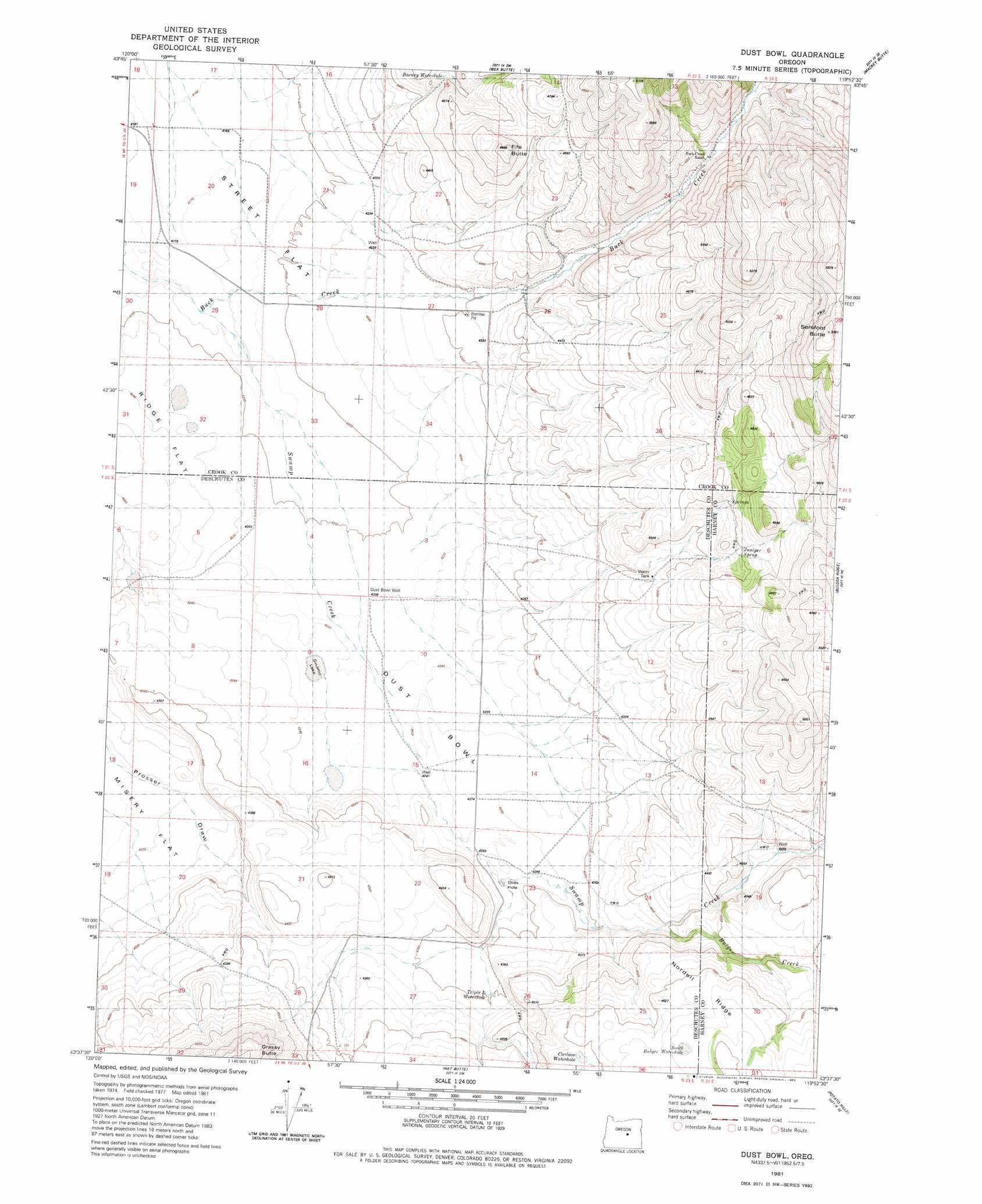
USGS Topo Quad 43119f8 - 1:24,000 scale
| Topo Map Name: | Dust Bowl |
| USGS Topo Quad ID: | 43119f8 |
| Print Size: | ca. 21 1/4" wide x 27" high |
| Southeast Coordinates: | 43.625° N latitude / 119.875° W longitude |
| Map Center Coordinates: | 43.6875° N latitude / 119.9375° W longitude |
| U.S. State: | OR |
| Filename: | o43119f8.jpg |
| Download Map JPG Image: | Dust Bowl topo map 1:24,000 scale |
| Map Type: | Topographic |
| Topo Series: | 7.5´ |
| Map Scale: | 1:24,000 |
| Source of Map Images: | United States Geological Survey (USGS) |
| Alternate Map Versions: |
Dust Bowl OR 1981, updated 1982 Download PDF Buy paper map Dust Bowl OR 2011 Download PDF Buy paper map Dust Bowl OR 2014 Download PDF Buy paper map |
1:24,000 Topo Quads surrounding Dust Bowl
Gerry Mountain |
Sand Hollow |
Hardin Ranch |
Twelvemile Reservoir |
Delintment Lake |
Long Barn |
G. I. Ranch |
Ibex Butte |
Mackey Butte |
Buck Spring |
Hampton |
Misery Flat |
Dust Bowl |
Bulger Ridge |
Camp Currey Spring |
Potato Lake |
Glass Butte |
Hat Butte |
Potato Hills |
Suntex |
Chicago Valley |
Tired Horse Butte |
Round Top Butte |
Hay Lake |
Squaw Butte |
> Back to 43119e1 at 1:100,000 scale
> Back to 43118a1 at 1:250,000 scale
> Back to U.S. Topo Maps home
Dust Bowl topo map: Gazetteer
Dust Bowl: Flats
Dust Bowl elevation 1290m 4232′Misery Flat elevation 1287m 4222′
Dust Bowl: Post Offices
Fife Post Office (historical) elevation 1275m 4183′Dust Bowl: Springs
Juniper Spring elevation 1409m 4622′Dust Bowl: Streams
Bulger Creek elevation 1351m 4432′Swamp Creek elevation 1276m 4186′
Dust Bowl digital topo map on disk
Buy this Dust Bowl topo map showing relief, roads, GPS coordinates and other geographical features, as a high-resolution digital map file on DVD: