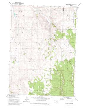
Mackey Butte Topo Map Oregon
To zoom in, hover over the map of Mackey Butte
USGS Topo Quad 43119g7 - 1:24,000 scale
| Topo Map Name: | Mackey Butte |
| USGS Topo Quad ID: | 43119g7 |
| Print Size: | ca. 21 1/4" wide x 27" high |
| Southeast Coordinates: | 43.75° N latitude / 119.75° W longitude |
| Map Center Coordinates: | 43.8125° N latitude / 119.8125° W longitude |
| U.S. State: | OR |
| Filename: | o43119g7.jpg |
| Download Map JPG Image: | Mackey Butte topo map 1:24,000 scale |
| Map Type: | Topographic |
| Topo Series: | 7.5´ |
| Map Scale: | 1:24,000 |
| Source of Map Images: | United States Geological Survey (USGS) |
| Alternate Map Versions: |
Mackey Butte OR 1981, updated 1981 Download PDF Buy paper map Mackey Butte OR 1992, updated 1997 Download PDF Buy paper map Mackey Butte OR 2011 Download PDF Buy paper map Mackey Butte OR 2014 Download PDF Buy paper map |
| FStopo: | US Forest Service topo Mackey Butte is available: Download FStopo PDF Download FStopo TIF |
1:24,000 Topo Quads surrounding Mackey Butte
> Back to 43119e1 at 1:100,000 scale
> Back to 43118a1 at 1:250,000 scale
> Back to U.S. Topo Maps home
Mackey Butte topo map: Gazetteer
Mackey Butte: Flats
Morris Meadows elevation 1583m 5193′Mackey Butte: Reservoirs
Freezeout Reservoir elevation 1406m 4612′Gravelly Flat Reservoir elevation 1583m 5193′
O'Keefe Reservoir elevation 1606m 5269′
Roadside Reservoir elevation 1595m 5232′
Rough Creek Reservoir elevation 1555m 5101′
Three Pines Reservoir elevation 1598m 5242′
Trails End Reservoir elevation 1616m 5301′
Mackey Butte: Ridges
Bradford Ridge elevation 1521m 4990′Freezeout Ridge elevation 1642m 5387′
Mackey Butte: Springs
Doe Spring elevation 1604m 5262′Mackey Butte: Summits
Mackey Butte elevation 1697m 5567′Saddle Butte elevation 1575m 5167′
Mackey Butte digital topo map on disk
Buy this Mackey Butte topo map showing relief, roads, GPS coordinates and other geographical features, as a high-resolution digital map file on DVD:


