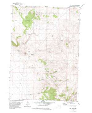
Ibex Butte Topo Map Oregon
To zoom in, hover over the map of Ibex Butte
USGS Topo Quad 43119g8 - 1:24,000 scale
| Topo Map Name: | Ibex Butte |
| USGS Topo Quad ID: | 43119g8 |
| Print Size: | ca. 21 1/4" wide x 27" high |
| Southeast Coordinates: | 43.75° N latitude / 119.875° W longitude |
| Map Center Coordinates: | 43.8125° N latitude / 119.9375° W longitude |
| U.S. State: | OR |
| Filename: | o43119g8.jpg |
| Download Map JPG Image: | Ibex Butte topo map 1:24,000 scale |
| Map Type: | Topographic |
| Topo Series: | 7.5´ |
| Map Scale: | 1:24,000 |
| Source of Map Images: | United States Geological Survey (USGS) |
| Alternate Map Versions: |
Ibex Butte OR 1981, updated 1982 Download PDF Buy paper map Ibex Butte OR 2011 Download PDF Buy paper map Ibex Butte OR 2014 Download PDF Buy paper map |
1:24,000 Topo Quads surrounding Ibex Butte
> Back to 43119e1 at 1:100,000 scale
> Back to 43118a1 at 1:250,000 scale
> Back to U.S. Topo Maps home
Ibex Butte topo map: Gazetteer
Ibex Butte: Reservoirs
Ibex Waterhole elevation 1395m 4576′Mills Waterhole elevation 1365m 4478′
Santry Waterhole elevation 1434m 4704′
Sartain Reservoir Number Two elevation 1318m 4324′
Twelvemile Reservoir Number Four elevation 1454m 4770′
Twelvemile Reservoir Number One elevation 1385m 4543′
Twelvemile Reservoir Number Three elevation 1371m 4498′
Twelvemile Reservoir Number Two elevation 1339m 4393′
Ibex Butte: Ridges
Willow Ridge elevation 1558m 5111′Ibex Butte: Springs
Juniper Spring elevation 1398m 4586′Rickman Spring elevation 1489m 4885′
Willow Springs elevation 1442m 4730′
Ibex Butte: Summits
Ann Butte elevation 1454m 4770′Ibex Butte elevation 1468m 4816′
Kid Peak elevation 1444m 4737′
Willow Butte elevation 1575m 5167′
Ibex Butte: Valleys
The Cove elevation 1388m 4553′Ibex Butte: Wells
Sera Well elevation 1391m 4563′Ibex Butte digital topo map on disk
Buy this Ibex Butte topo map showing relief, roads, GPS coordinates and other geographical features, as a high-resolution digital map file on DVD:


