Alkali Buttes Topo Map Oregon
To zoom in, hover over the map of Alkali Buttes
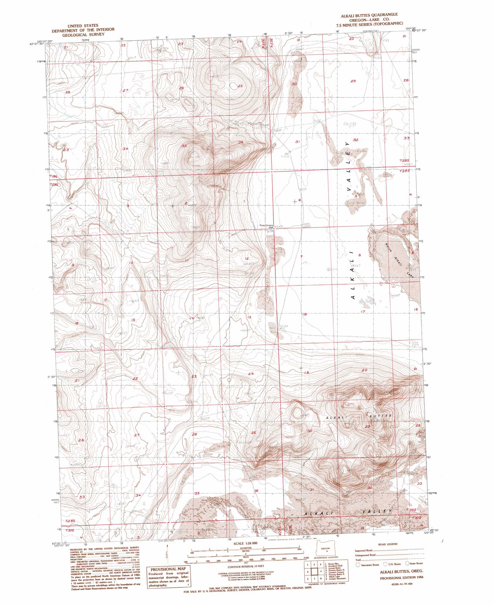
USGS Topo Quad 43120a1 - 1:24,000 scale
| Topo Map Name: | Alkali Buttes |
| USGS Topo Quad ID: | 43120a1 |
| Print Size: | ca. 21 1/4" wide x 27" high |
| Southeast Coordinates: | 43° N latitude / 120° W longitude |
| Map Center Coordinates: | 43.0625° N latitude / 120.0625° W longitude |
| U.S. State: | OR |
| Filename: | o43120a1.jpg |
| Download Map JPG Image: | Alkali Buttes topo map 1:24,000 scale |
| Map Type: | Topographic |
| Topo Series: | 7.5´ |
| Map Scale: | 1:24,000 |
| Source of Map Images: | United States Geological Survey (USGS) |
| Alternate Map Versions: |
Alkali Buttes OR 1984, updated 1984 Download PDF Buy paper map Alkali Buttes OR 2011 Download PDF Buy paper map Alkali Buttes OR 2014 Download PDF Buy paper map |
1:24,000 Topo Quads surrounding Alkali Buttes
Sand Rock |
Elk Butte |
Rams Butte |
Wagontire Mountain West |
Wagontire Mountain East |
Buffalo Well |
Horse Mountain |
Goodrich Well |
Locust Butte |
Little Juniper Mountain |
Fire Lake |
Poverty Basin North |
Alkali Buttes |
Venator Canyon |
Cox Canyon |
Diatomite Reservoir |
Poverty Basin South |
Alkali Lake |
Juniper Mountain |
Turpin Knoll |
Biscuit Point |
Sawed Horn |
Coleman Hills |
Sagebrush Knoll |
Corn Lake |
> Back to 43120a1 at 1:100,000 scale
> Back to 43120a1 at 1:250,000 scale
> Back to U.S. Topo Maps home
Alkali Buttes topo map: Gazetteer
Alkali Buttes: Lakes
North Alkali Lake elevation 1308m 4291′Alkali Buttes: Summits
Alkali Buttes elevation 1485m 4872′Alkali Buttes digital topo map on disk
Buy this Alkali Buttes topo map showing relief, roads, GPS coordinates and other geographical features, as a high-resolution digital map file on DVD: