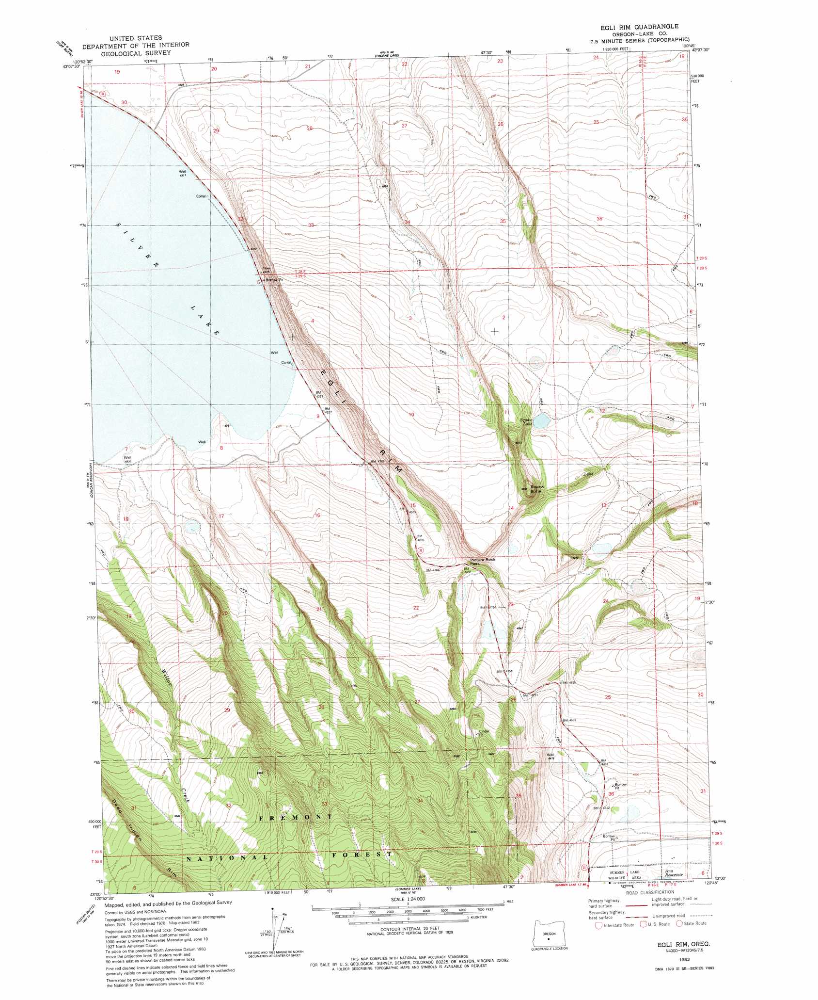
Egli Rim Topo Map Oregon
To zoom in, hover over the map of Egli Rim
USGS Topo Quad 43120a7 - 1:24,000 scale
| Topo Map Name: | Egli Rim |
| USGS Topo Quad ID: | 43120a7 |
| Print Size: | ca. 21 1/4" wide x 27" high |
| Southeast Coordinates: | 43° N latitude / 120.75° W longitude |
| Map Center Coordinates: | 43.0625° N latitude / 120.8125° W longitude |
| U.S. State: | OR |
| Filename: | o43120a7.jpg |
| Download Map JPG Image: | Egli Rim topo map 1:24,000 scale |
| Map Type: | Topographic |
| Topo Series: | 7.5´ |
| Map Scale: | 1:24,000 |
| Source of Map Images: | United States Geological Survey (USGS) |
| Alternate Map Versions: |
Egli Rim OR 1982, updated 1982 Download PDF Buy paper map Egli Rim OR 2004, updated 2007 Download PDF Buy paper map Egli Rim OR 2011 Download PDF Buy paper map Egli Rim OR 2014 Download PDF Buy paper map |
| FStopo: | US Forest Service topo Egli Rim is available: Download FStopo PDF Download FStopo TIF |
1:24,000 Topo Quads surrounding Egli Rim
Fort Rock |
Schaub Lake |
Lane Lake |
Crack In The Ground |
Christmas Lake |
Silver Lake |
Tuff Butte |
Thorn Lake |
Christmas Valley |
Fandango Canyon |
Hager Mountain |
Duncan Reservoir |
Egli Rim |
Sheeplick Draw |
Saint Patrick Mountain |
Thompson Reservoir |
Foster Butte |
Summer Lake |
Ana River |
Diablo Peak |
Sycan Marsh East |
Pole Butte |
Fremont Point |
South Of Ana River |
Loco Lake |
> Back to 43120a1 at 1:100,000 scale
> Back to 43120a1 at 1:250,000 scale
> Back to U.S. Topo Maps home
Egli Rim topo map: Gazetteer
Egli Rim: Basins
Weaver Waterhole elevation 1328m 4356′Egli Rim: Cliffs
Egli Rim elevation 1331m 4366′Egli Rim: Reservoirs
Egli Rim Reservoir Number One elevation 1404m 4606′Egli Rim Reservoir Number Two elevation 1596m 5236′
Muddy Waterhole elevation 1561m 5121′
Rocky Waterhole elevation 1387m 4550′
Egli Rim: Streams
Willow Creek elevation 1355m 4445′Egli Rim digital topo map on disk
Buy this Egli Rim topo map showing relief, roads, GPS coordinates and other geographical features, as a high-resolution digital map file on DVD: