Rams Butte Topo Map Oregon
To zoom in, hover over the map of Rams Butte
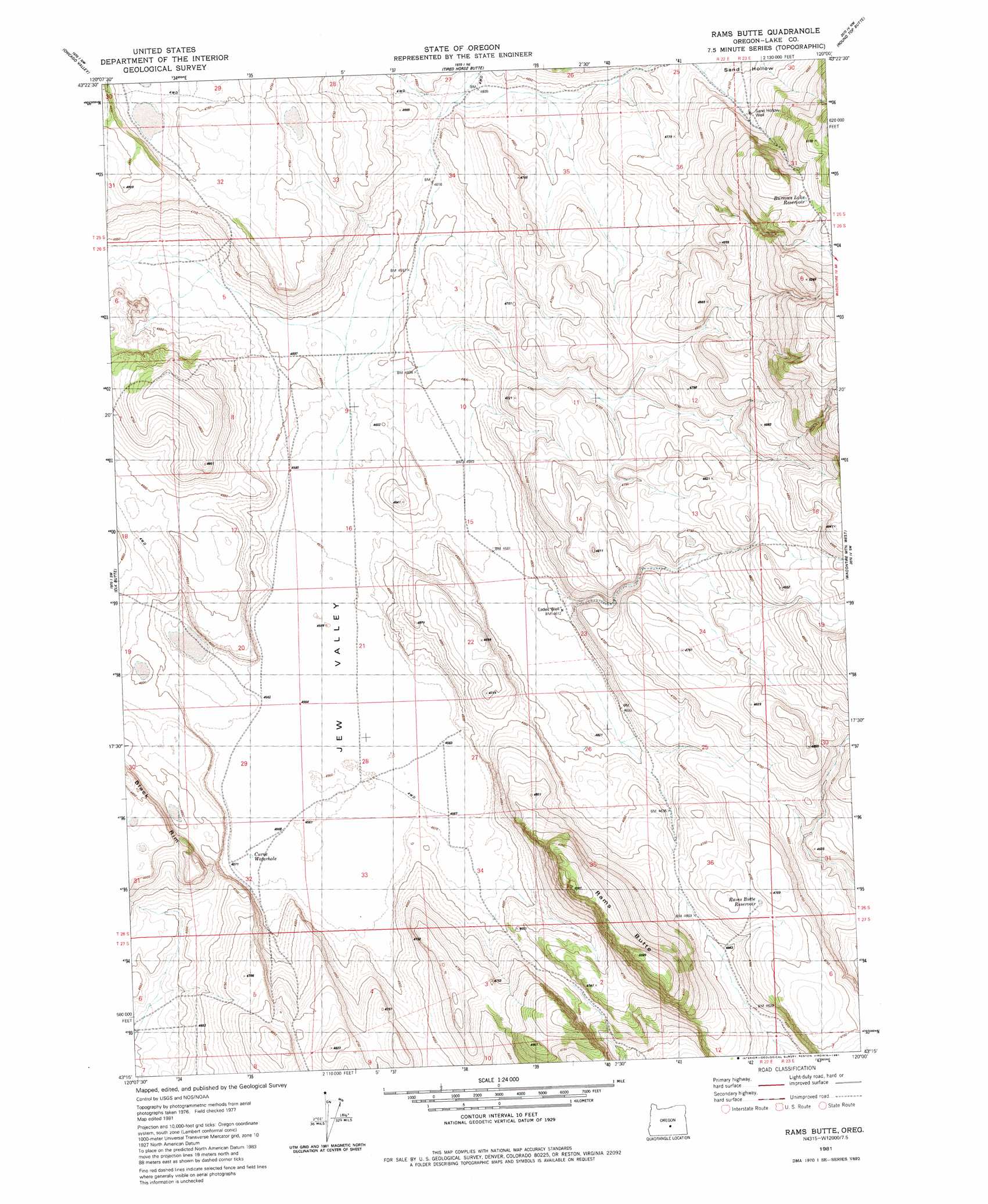
USGS Topo Quad 43120c1 - 1:24,000 scale
| Topo Map Name: | Rams Butte |
| USGS Topo Quad ID: | 43120c1 |
| Print Size: | ca. 21 1/4" wide x 27" high |
| Southeast Coordinates: | 43.25° N latitude / 120° W longitude |
| Map Center Coordinates: | 43.3125° N latitude / 120.0625° W longitude |
| U.S. State: | OR |
| Filename: | o43120c1.jpg |
| Download Map JPG Image: | Rams Butte topo map 1:24,000 scale |
| Map Type: | Topographic |
| Topo Series: | 7.5´ |
| Map Scale: | 1:24,000 |
| Source of Map Images: | United States Geological Survey (USGS) |
| Alternate Map Versions: |
Rams Butte OR 1981, updated 1981 Download PDF Buy paper map Rams Butte OR 2011 Download PDF Buy paper map Rams Butte OR 2014 Download PDF Buy paper map |
1:24,000 Topo Quads surrounding Rams Butte
Benjamin Lake |
Potato Lake |
Glass Butte |
Hat Butte |
Potato Hills |
Moonlight Butte |
Chicago Valley |
Tired Horse Butte |
Round Top Butte |
Hay Lake |
Sand Rock |
Elk Butte |
Rams Butte |
Wagontire Mountain West |
Wagontire Mountain East |
Buffalo Well |
Horse Mountain |
Goodrich Well |
Locust Butte |
Little Juniper Mountain |
Fire Lake |
Poverty Basin North |
Alkali Buttes |
Venator Canyon |
Cox Canyon |
> Back to 43120a1 at 1:100,000 scale
> Back to 43120a1 at 1:250,000 scale
> Back to U.S. Topo Maps home
Rams Butte topo map: Gazetteer
Rams Butte: Basins
Jew Valley elevation 1392m 4566′Rams Butte: Reservoirs
Burrows Lake Reservoir elevation 1540m 5052′Curve Waterhole elevation 1393m 4570′
Rams Butte Reservoir elevation 1443m 4734′
Rams Butte: Summits
Rams Butte elevation 1522m 4993′Rams Butte: Valleys
Black Canyon elevation 1412m 4632′Rams Butte: Wells
Eades Well elevation 1405m 4609′Sand Hollow Well elevation 1460m 4790′
Rams Butte digital topo map on disk
Buy this Rams Butte topo map showing relief, roads, GPS coordinates and other geographical features, as a high-resolution digital map file on DVD: