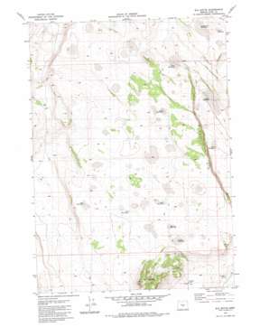
Elk Butte Topo Map Oregon
To zoom in, hover over the map of Elk Butte
USGS Topo Quad 43120c2 - 1:24,000 scale
| Topo Map Name: | Elk Butte |
| USGS Topo Quad ID: | 43120c2 |
| Print Size: | ca. 21 1/4" wide x 27" high |
| Southeast Coordinates: | 43.25° N latitude / 120.125° W longitude |
| Map Center Coordinates: | 43.3125° N latitude / 120.1875° W longitude |
| U.S. State: | OR |
| Filename: | o43120c2.jpg |
| Download Map JPG Image: | Elk Butte topo map 1:24,000 scale |
| Map Type: | Topographic |
| Topo Series: | 7.5´ |
| Map Scale: | 1:24,000 |
| Source of Map Images: | United States Geological Survey (USGS) |
| Alternate Map Versions: |
Elk Butte OR 1981, updated 1981 Download PDF Buy paper map Elk Butte OR 2011 Download PDF Buy paper map Elk Butte OR 2014 Download PDF Buy paper map |
1:24,000 Topo Quads surrounding Elk Butte
> Back to 43120a1 at 1:100,000 scale
> Back to 43120a1 at 1:250,000 scale
> Back to U.S. Topo Maps home
Elk Butte topo map: Gazetteer
Elk Butte: Cliffs
Black Rim elevation 1429m 4688′Elk Butte: Reservoirs
Best Waterhole elevation 1467m 4812′Bourbon Waterhole elevation 1468m 4816′
Dry Lake Waterhole elevation 1411m 4629′
Folder Waterhole elevation 1437m 4714′
Geyser Waterhole elevation 1473m 4832′
Immigrant Waterhole elevation 1450m 4757′
Jewel Waterhole elevation 1406m 4612′
Oblong Waterhole elevation 1410m 4625′
Schlitz Waterhole elevation 1458m 4783′
Smokey Waterhole elevation 1461m 4793′
Spook Waterhole elevation 1467m 4812′
Viv Waterhole elevation 1473m 4832′
Elk Butte: Summits
Dragon Rock elevation 1410m 4625′Elk Butte elevation 1596m 5236′
Elk Mountain elevation 1555m 5101′
Elk Butte: Wells
Jinx Well elevation 1472m 4829′Elk Butte digital topo map on disk
Buy this Elk Butte topo map showing relief, roads, GPS coordinates and other geographical features, as a high-resolution digital map file on DVD:


