Peters Creek Sink Topo Map Oregon
To zoom in, hover over the map of Peters Creek Sink
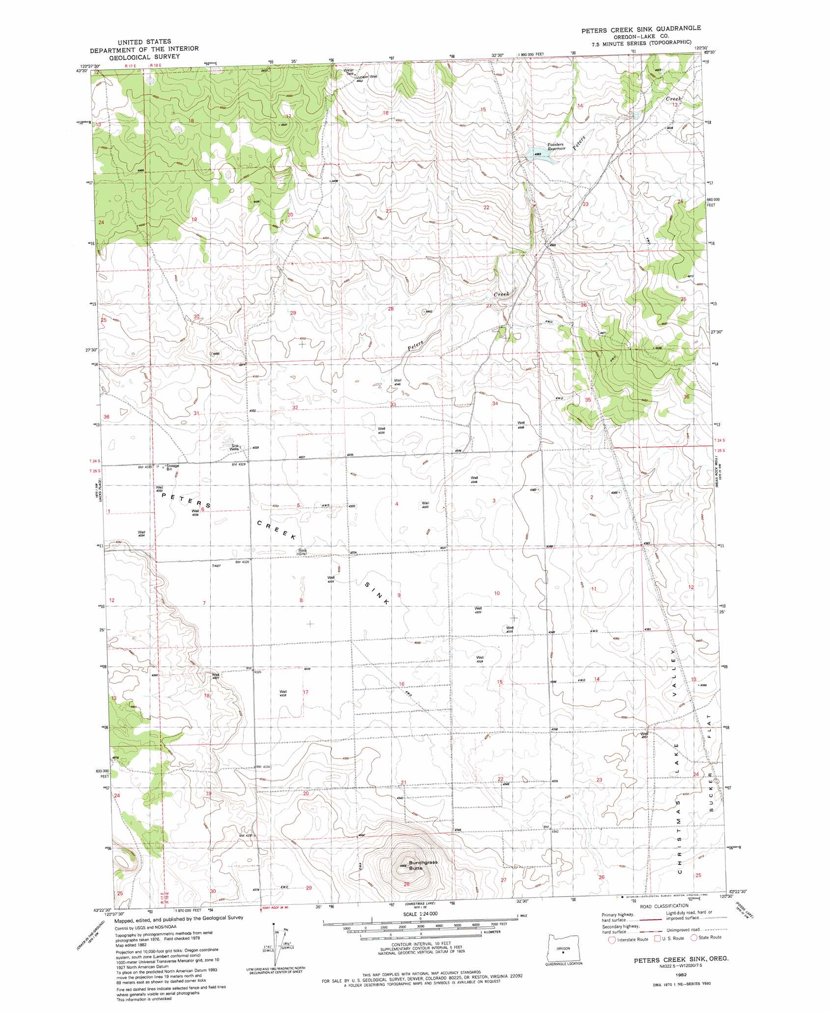
USGS Topo Quad 43120d5 - 1:24,000 scale
| Topo Map Name: | Peters Creek Sink |
| USGS Topo Quad ID: | 43120d5 |
| Print Size: | ca. 21 1/4" wide x 27" high |
| Southeast Coordinates: | 43.375° N latitude / 120.5° W longitude |
| Map Center Coordinates: | 43.4375° N latitude / 120.5625° W longitude |
| U.S. State: | OR |
| Filename: | o43120d5.jpg |
| Download Map JPG Image: | Peters Creek Sink topo map 1:24,000 scale |
| Map Type: | Topographic |
| Topo Series: | 7.5´ |
| Map Scale: | 1:24,000 |
| Source of Map Images: | United States Geological Survey (USGS) |
| Alternate Map Versions: |
Peters Creek Sink OR 1982, updated 1982 Download PDF Buy paper map Peters Creek Sink OR 2011 Download PDF Buy paper map Peters Creek Sink OR 2014 Download PDF Buy paper map |
1:24,000 Topo Quads surrounding Peters Creek Sink
Plot Butte |
Dickerson Flat |
Soldiers Gap |
Imperial Valley South |
West Of Hampston |
Fox Butte |
Walker Butte |
Last Chance Lake |
Frederick Butte |
Benjamin Lake |
Hogback Butte |
Jacks Place |
Peters Creek Sink |
Mean Rock Well |
Moonlight Butte |
Lane Lake |
Crack In The Ground |
Christmas Lake |
Fossil Lake |
Sand Rock |
Thorn Lake |
Christmas Valley |
Fandango Canyon |
Vaughn Well |
Buffalo Well |
> Back to 43120a1 at 1:100,000 scale
> Back to 43120a1 at 1:250,000 scale
> Back to U.S. Topo Maps home
Peters Creek Sink topo map: Gazetteer
Peters Creek Sink: Flats
Peters Lake elevation 1324m 4343′Peters Creek Sink: Plains
Sage Plains elevation 1339m 4393′Peters Creek Sink: Post Offices
Sink Post Office (historical) elevation 1324m 4343′Peters Creek Sink: Streams
Peters Creek elevation 1324m 4343′Walker Creek elevation 1326m 4350′
Peters Creek Sink: Summits
Bunchgrass Butte elevation 1353m 4438′Peters Creek Sink digital topo map on disk
Buy this Peters Creek Sink topo map showing relief, roads, GPS coordinates and other geographical features, as a high-resolution digital map file on DVD: