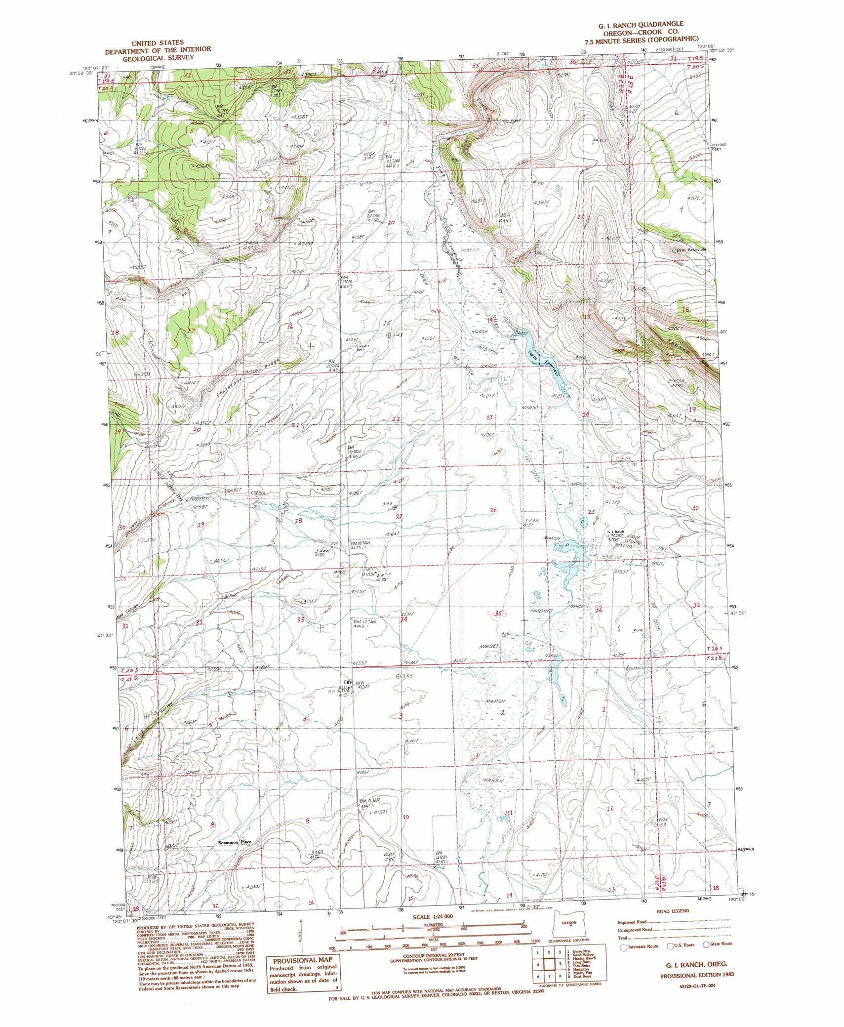
G. I. Ranch Topo Map Oregon
To zoom in, hover over the map of G. I. Ranch
USGS Topo Quad 43120g1 - 1:24,000 scale
| Topo Map Name: | G. I. Ranch |
| USGS Topo Quad ID: | 43120g1 |
| Print Size: | ca. 21 1/4" wide x 27" high |
| Southeast Coordinates: | 43.75° N latitude / 120° W longitude |
| Map Center Coordinates: | 43.8125° N latitude / 120.0625° W longitude |
| U.S. State: | OR |
| Filename: | o43120g1.jpg |
| Download Map JPG Image: | G. I. Ranch topo map 1:24,000 scale |
| Map Type: | Topographic |
| Topo Series: | 7.5´ |
| Map Scale: | 1:24,000 |
| Source of Map Images: | United States Geological Survey (USGS) |
| Alternate Map Versions: |
G.I. Ranch OR 1983, updated 1983 Download PDF Buy paper map G I Ranch OR 2011 Download PDF Buy paper map G I Ranch OR 2014 Download PDF Buy paper map |
1:24,000 Topo Quads surrounding G. I. Ranch
Drake Butte |
Arrowwood Point |
Liggett Table |
Maupin Butte |
Angell Butte |
Logan Butte |
Gerry Mountain |
Sand Hollow |
Hardin Ranch |
Twelvemile Reservoir |
Hampton Butte |
Long Barn |
G. I. Ranch |
Ibex Butte |
Mackey Butte |
West Of Hampston |
Hampton |
Misery Flat |
Dust Bowl |
Bulger Ridge |
Benjamin Lake |
Potato Lake |
Glass Butte |
Hat Butte |
Potato Hills |
> Back to 43120e1 at 1:100,000 scale
> Back to 43120a1 at 1:250,000 scale
> Back to U.S. Topo Maps home
G. I. Ranch topo map: Gazetteer
G. I. Ranch: Cliffs
Rodman Rim elevation 1480m 4855′G. I. Ranch: Post Offices
Ibex Post Office (historical) elevation 1263m 4143′G. I. Ranch: Reservoirs
Logan Reservoir elevation 1258m 4127′G. I. Ranch digital topo map on disk
Buy this G. I. Ranch topo map showing relief, roads, GPS coordinates and other geographical features, as a high-resolution digital map file on DVD: