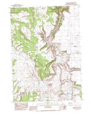
Sand Hollow Topo Map Oregon
To zoom in, hover over the map of Sand Hollow
USGS Topo Quad 43120h1 - 1:24,000 scale
| Topo Map Name: | Sand Hollow |
| USGS Topo Quad ID: | 43120h1 |
| Print Size: | ca. 21 1/4" wide x 27" high |
| Southeast Coordinates: | 43.875° N latitude / 120° W longitude |
| Map Center Coordinates: | 43.9375° N latitude / 120.0625° W longitude |
| U.S. State: | OR |
| Filename: | o43120h1.jpg |
| Download Map JPG Image: | Sand Hollow topo map 1:24,000 scale |
| Map Type: | Topographic |
| Topo Series: | 7.5´ |
| Map Scale: | 1:24,000 |
| Source of Map Images: | United States Geological Survey (USGS) |
| Alternate Map Versions: |
Sand Hollow OR 1983, updated 1983 Download PDF Buy paper map Sand Hollow OR 2011 Download PDF Buy paper map Sand Hollow OR 2014 Download PDF Buy paper map |
1:24,000 Topo Quads surrounding Sand Hollow
> Back to 43120e1 at 1:100,000 scale
> Back to 43120a1 at 1:250,000 scale
> Back to U.S. Topo Maps home
Sand Hollow topo map: Gazetteer
Sand Hollow: Basins
Sand Hollow elevation 1248m 4094′Sand Hollow: Cliffs
Orr Point elevation 1389m 4557′Sand Hollow: Lakes
Dagus Lake elevation 1363m 4471′Pickett Lake elevation 1377m 4517′
Sand Hollow: Post Offices
Coldspring Post Office (historical) elevation 1241m 4071′Sand Hollow: Reservoirs
Corner Reservoir elevation 1347m 4419′Divide Waterhole elevation 1393m 4570′
Division Waterhole elevation 1382m 4534′
Furnace Waterhole elevation 1361m 4465′
Lillard Lake elevation 1371m 4498′
Pickett Waterhole elevation 1378m 4520′
Reservoir Number Six elevation 1390m 4560′
South Dagus Reservoir elevation 1350m 4429′
Sand Hollow: Ridges
Steens Ridge elevation 1496m 4908′Sand Hollow: Springs
Soda Spring elevation 1191m 3907′Sand Hollow: Streams
Sand Hollow Creek elevation 1223m 4012′Twelvemile Creek elevation 1215m 3986′
Sand Hollow: Valleys
Bedell Canyon elevation 1193m 3914′Sheep Head Canyon elevation 1237m 4058′
Sand Hollow: Wells
Sand Hollow Well elevation 1269m 4163′Sand Hollow digital topo map on disk
Buy this Sand Hollow topo map showing relief, roads, GPS coordinates and other geographical features, as a high-resolution digital map file on DVD:


