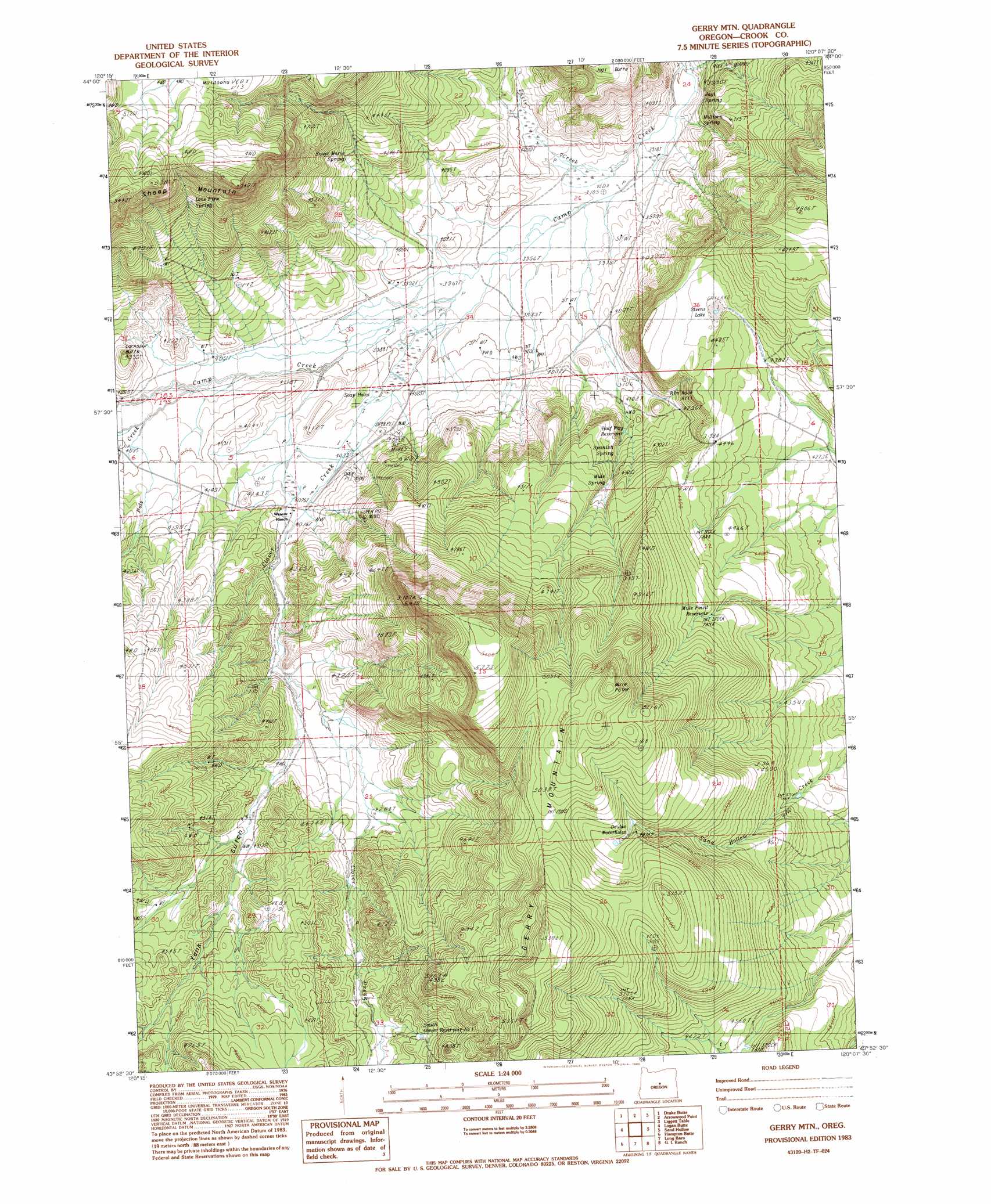
Gerry Mountain Topo Map Oregon
To zoom in, hover over the map of Gerry Mountain
USGS Topo Quad 43120h2 - 1:24,000 scale
| Topo Map Name: | Gerry Mountain |
| USGS Topo Quad ID: | 43120h2 |
| Print Size: | ca. 21 1/4" wide x 27" high |
| Southeast Coordinates: | 43.875° N latitude / 120.125° W longitude |
| Map Center Coordinates: | 43.9375° N latitude / 120.1875° W longitude |
| U.S. State: | OR |
| Filename: | o43120h2.jpg |
| Download Map JPG Image: | Gerry Mountain topo map 1:24,000 scale |
| Map Type: | Topographic |
| Topo Series: | 7.5´ |
| Map Scale: | 1:24,000 |
| Source of Map Images: | United States Geological Survey (USGS) |
| Alternate Map Versions: |
Gerry Mtn OR 1983, updated 1983 Download PDF Buy paper map Gerry Mountain OR 2011 Download PDF Buy paper map Gerry Mountain OR 2014 Download PDF Buy paper map |
1:24,000 Topo Quads surrounding Gerry Mountain
Post |
Prairie Hill |
Committee Creek |
Rabbit Valley |
Paulina |
Mule Deer Ridge |
Drake Butte |
Arrowwood Point |
Liggett Table |
Maupin Butte |
Pringle Flat |
Logan Butte |
Gerry Mountain |
Sand Hollow |
Hardin Ranch |
Imperial Valley North |
Hampton Butte |
Long Barn |
G. I. Ranch |
Ibex Butte |
Imperial Valley South |
West Of Hampston |
Hampton |
Misery Flat |
Dust Bowl |
> Back to 43120e1 at 1:100,000 scale
> Back to 43120a1 at 1:250,000 scale
> Back to U.S. Topo Maps home
Gerry Mountain topo map: Gazetteer
Gerry Mountain: Post Offices
Silver Wells Post Office (historical) elevation 1511m 4957′Gerry Mountain: Streams
Clover Creek elevation 1208m 3963′Pole Creek elevation 1242m 4074′
South Fork Camp Creek elevation 1213m 3979′
Gerry Mountain: Summits
Gerry Mountain elevation 1600m 5249′Moon Mountain elevation 1560m 5118′
Gerry Mountain: Valleys
Yank Gulch elevation 1271m 4169′Gerry Mountain digital topo map on disk
Buy this Gerry Mountain topo map showing relief, roads, GPS coordinates and other geographical features, as a high-resolution digital map file on DVD: