Sugarloaf Butte Topo Map Oregon
To zoom in, hover over the map of Sugarloaf Butte
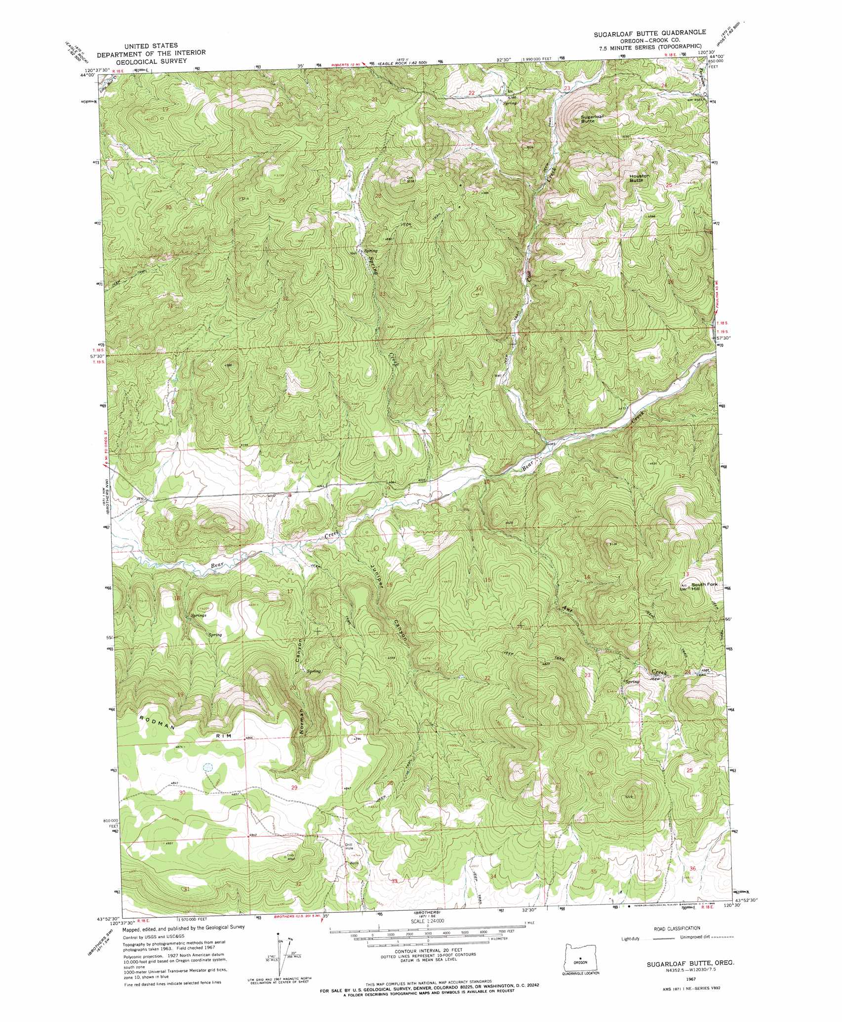
USGS Topo Quad 43120h5 - 1:24,000 scale
| Topo Map Name: | Sugarloaf Butte |
| USGS Topo Quad ID: | 43120h5 |
| Print Size: | ca. 21 1/4" wide x 27" high |
| Southeast Coordinates: | 43.875° N latitude / 120.5° W longitude |
| Map Center Coordinates: | 43.9375° N latitude / 120.5625° W longitude |
| U.S. State: | OR |
| Filename: | o43120h5.jpg |
| Download Map JPG Image: | Sugarloaf Butte topo map 1:24,000 scale |
| Map Type: | Topographic |
| Topo Series: | 7.5´ |
| Map Scale: | 1:24,000 |
| Source of Map Images: | United States Geological Survey (USGS) |
| Alternate Map Versions: |
Sugarloaf Butte OR 1967, updated 1968 Download PDF Buy paper map Sugarloaf Butte OR 1992, updated 1997 Download PDF Buy paper map Sugarloaf Butte OR 2011 Download PDF Buy paper map Sugarloaf Butte OR 2014 Download PDF Buy paper map |
| FStopo: | US Forest Service topo Sugarloaf Butte is available: Download FStopo PDF Download FStopo TIF |
1:24,000 Topo Quads surrounding Sugarloaf Butte
Stearns Butte |
Eagle Rock |
Pilot Butte |
Post |
Prairie Hill |
Bowman Dam |
Alkali Flat |
Conant Basin |
Mule Deer Ridge |
Drake Butte |
West Butte |
Rodman Ridge |
Sugarloaf Butte |
Pringle Flat |
Logan Butte |
Millican Se |
Brothers Sw |
Brothers |
Imperial Valley North |
Hampton Butte |
Plot Butte |
Dickerson Flat |
Soldiers Gap |
Imperial Valley South |
West Of Hampston |
> Back to 43120e1 at 1:100,000 scale
> Back to 43120a1 at 1:250,000 scale
> Back to U.S. Topo Maps home
Sugarloaf Butte topo map: Gazetteer
Sugarloaf Butte: Streams
Ant Creek elevation 1230m 4035′Cow Creek elevation 1243m 4078′
Little Deer Creek elevation 1433m 4701′
Spring Creek elevation 1219m 3999′
Sugarloaf Butte: Summits
Houston Butte elevation 1612m 5288′Milliorn Hill elevation 1590m 5216′
South Fork Hill elevation 1612m 5288′
Sugarloaf Butte elevation 1606m 5269′
Sugarloaf Butte: Valleys
Juniper Canyon elevation 1209m 3966′Norman Canyon elevation 1199m 3933′
Sugarloaf Butte digital topo map on disk
Buy this Sugarloaf Butte topo map showing relief, roads, GPS coordinates and other geographical features, as a high-resolution digital map file on DVD: