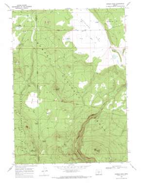
Rodman Rock Topo Map Oregon
To zoom in, hover over the map of Rodman Rock
USGS Topo Quad 43121a3 - 1:24,000 scale
| Topo Map Name: | Rodman Rock |
| USGS Topo Quad ID: | 43121a3 |
| Print Size: | ca. 21 1/4" wide x 27" high |
| Southeast Coordinates: | 43° N latitude / 121.25° W longitude |
| Map Center Coordinates: | 43.0625° N latitude / 121.3125° W longitude |
| U.S. State: | OR |
| Filename: | o43121a3.jpg |
| Download Map JPG Image: | Rodman Rock topo map 1:24,000 scale |
| Map Type: | Topographic |
| Topo Series: | 7.5´ |
| Map Scale: | 1:24,000 |
| Source of Map Images: | United States Geological Survey (USGS) |
| Alternate Map Versions: |
Rodman Rock OR 1968, updated 1971 Download PDF Buy paper map Rodman Rock OR 1999, updated 2002 Download PDF Buy paper map Rodman Rock OR 2011 Download PDF Buy paper map Rodman Rock OR 2014 Download PDF Buy paper map |
| FStopo: | US Forest Service topo Rodman Rock is available: Download FStopo PDF Download FStopo TIF |
1:24,000 Topo Quads surrounding Rodman Rock
> Back to 43121a1 at 1:100,000 scale
> Back to 43120a1 at 1:250,000 scale
> Back to U.S. Topo Maps home
Rodman Rock topo map: Gazetteer
Rodman Rock: Flats
Antelope Flat elevation 1492m 4895′Little Antelope Flat elevation 1513m 4963′
McCarty Field elevation 1666m 5465′
McCarty Flat elevation 1658m 5439′
Rodman Rock: Lakes
Antelope Lake elevation 1491m 4891′Rodman Rock: Springs
Bear Spring elevation 1524m 5000′Boundary Spring elevation 1788m 5866′
Coffeepot Spring elevation 1732m 5682′
Road Spring elevation 1832m 6010′
Section One Spring elevation 1747m 5731′
Still Spring elevation 1605m 5265′
Trapper Spring elevation 1683m 5521′
Rodman Rock: Streams
Rock Creek elevation 1501m 4924′Rodman Rock: Summits
Dillon Butte elevation 1851m 6072′McCarty Butte elevation 1733m 5685′
Rodman Rock elevation 2047m 6715′
Rodman Rock: Wells
Antelope Well elevation 1492m 4895′Rodman Rock digital topo map on disk
Buy this Rodman Rock topo map showing relief, roads, GPS coordinates and other geographical features, as a high-resolution digital map file on DVD:


