Chemult Topo Map Oregon
To zoom in, hover over the map of Chemult
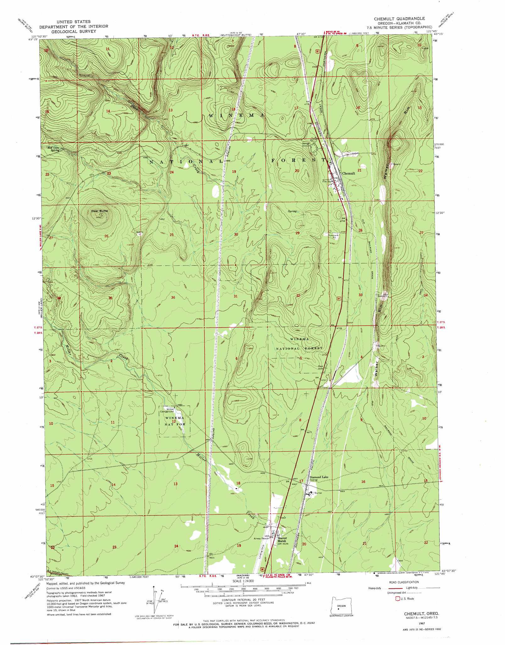
USGS Topo Quad 43121b7 - 1:24,000 scale
| Topo Map Name: | Chemult |
| USGS Topo Quad ID: | 43121b7 |
| Print Size: | ca. 21 1/4" wide x 27" high |
| Southeast Coordinates: | 43.125° N latitude / 121.75° W longitude |
| Map Center Coordinates: | 43.1875° N latitude / 121.8125° W longitude |
| U.S. State: | OR |
| Filename: | o43121b7.jpg |
| Download Map JPG Image: | Chemult topo map 1:24,000 scale |
| Map Type: | Topographic |
| Topo Series: | 7.5´ |
| Map Scale: | 1:24,000 |
| Source of Map Images: | United States Geological Survey (USGS) |
| Alternate Map Versions: |
Chemult OR 1967, updated 1970 Download PDF Buy paper map Chemult OR 1999, updated 2002 Download PDF Buy paper map Chemult OR 2011 Download PDF Buy paper map Chemult OR 2014 Download PDF Buy paper map |
| FStopo: | US Forest Service topo Chemult is available: Download FStopo PDF Download FStopo TIF |
1:24,000 Topo Quads surrounding Chemult
Cowhorn Mountain |
Crescent Lake |
Odell Butte |
Crescent |
Crescent Ne |
Tolo Mountain |
Burn Butte |
Muttonchop Butte |
Walker Mountain |
Sellers Marsh |
Mount Thielsen |
Miller Lake |
Chemult |
Sugarpine Mountain Nw |
Tea Table Mountain |
Pumice Desert East |
Welch Butte |
Mazama |
Round Butte |
Sugarpine Mountain |
Crater Lake East |
Pothole Butte |
Lenz |
Military Crossing |
Wildhorse Ridge |
> Back to 43121a1 at 1:100,000 scale
> Back to 43120a1 at 1:250,000 scale
> Back to U.S. Topo Maps home
Chemult topo map: Gazetteer
Chemult: Airports
Beaver Marsh State Airport elevation 1413m 4635′Chemult: Populated Places
Chemult elevation 1452m 4763′Chemult: Post Offices
Beaver Marsh Post Office (historical) elevation 1414m 4639′Chemult Post Office elevation 1452m 4763′
Chemult: Springs
Murphy Spring elevation 1476m 4842′Red Cone Spring elevation 1556m 5104′
Chemult: Streams
Deer Creek elevation 1448m 4750′Miller Creek elevation 1413m 4635′
Chemult: Summits
Deer Butte elevation 1655m 5429′Chemult: Swamps
Beaver Marsh elevation 1417m 4648′Chemult digital topo map on disk
Buy this Chemult topo map showing relief, roads, GPS coordinates and other geographical features, as a high-resolution digital map file on DVD: