Indian Butte Topo Map Oregon
To zoom in, hover over the map of Indian Butte
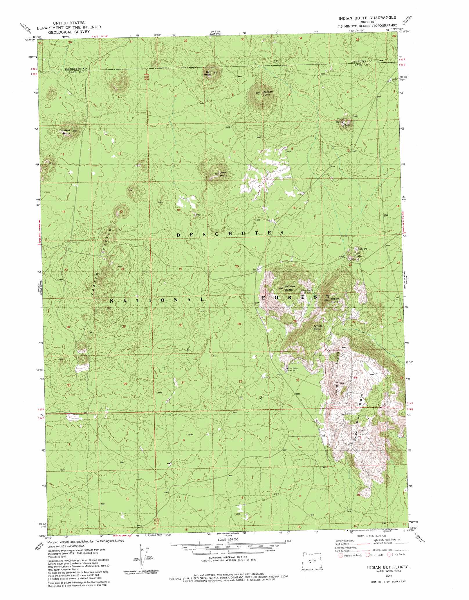
USGS Topo Quad 43121e2 - 1:24,000 scale
| Topo Map Name: | Indian Butte |
| USGS Topo Quad ID: | 43121e2 |
| Print Size: | ca. 21 1/4" wide x 27" high |
| Southeast Coordinates: | 43.5° N latitude / 121.125° W longitude |
| Map Center Coordinates: | 43.5625° N latitude / 121.1875° W longitude |
| U.S. State: | OR |
| Filename: | o43121e2.jpg |
| Download Map JPG Image: | Indian Butte topo map 1:24,000 scale |
| Map Type: | Topographic |
| Topo Series: | 7.5´ |
| Map Scale: | 1:24,000 |
| Source of Map Images: | United States Geological Survey (USGS) |
| Alternate Map Versions: |
Indian Butte OR 1982, updated 1982 Download PDF Buy paper map Indian Butte OR 2011 Download PDF Buy paper map Indian Butte OR 2014 Download PDF Buy paper map |
| FStopo: | US Forest Service topo Indian Butte is available: Download FStopo PDF Download FStopo TIF |
1:24,000 Topo Quads surrounding Indian Butte
Anns Butte |
Lava Cast Forest |
Fuzztail Butte |
Evans Well |
Pine Mountain |
Finley Butte |
Paulina Peak |
East Lake |
China Hat |
Firestone Butte |
Moffitt Butte |
Spring Butte |
Indian Butte |
South Ice Cave |
Sixteen Butte |
Grass Well |
Big Hole |
Hole In The Ground |
Cabin Lake |
Cougar Mountain |
Stams Mountain |
Wickiup Spring |
Mccarty Butte |
Fort Rock |
Schaub Lake |
> Back to 43121e1 at 1:100,000 scale
> Back to 43120a1 at 1:250,000 scale
> Back to U.S. Topo Maps home
Indian Butte topo map: Gazetteer
Indian Butte: Ridges
Sugar Pine Ridge elevation 1614m 5295′Indian Butte: Summits
Amota Butte elevation 1725m 5659′Crater Buttes elevation 1750m 5741′
Indian Butte elevation 1691m 5547′
Red Butte elevation 1618m 5308′
Willow Butte elevation 1763m 5784′
Youtlkut Butte elevation 1722m 5649′
Indian Butte digital topo map on disk
Buy this Indian Butte topo map showing relief, roads, GPS coordinates and other geographical features, as a high-resolution digital map file on DVD: