Lava Butte Topo Map Oregon
To zoom in, hover over the map of Lava Butte
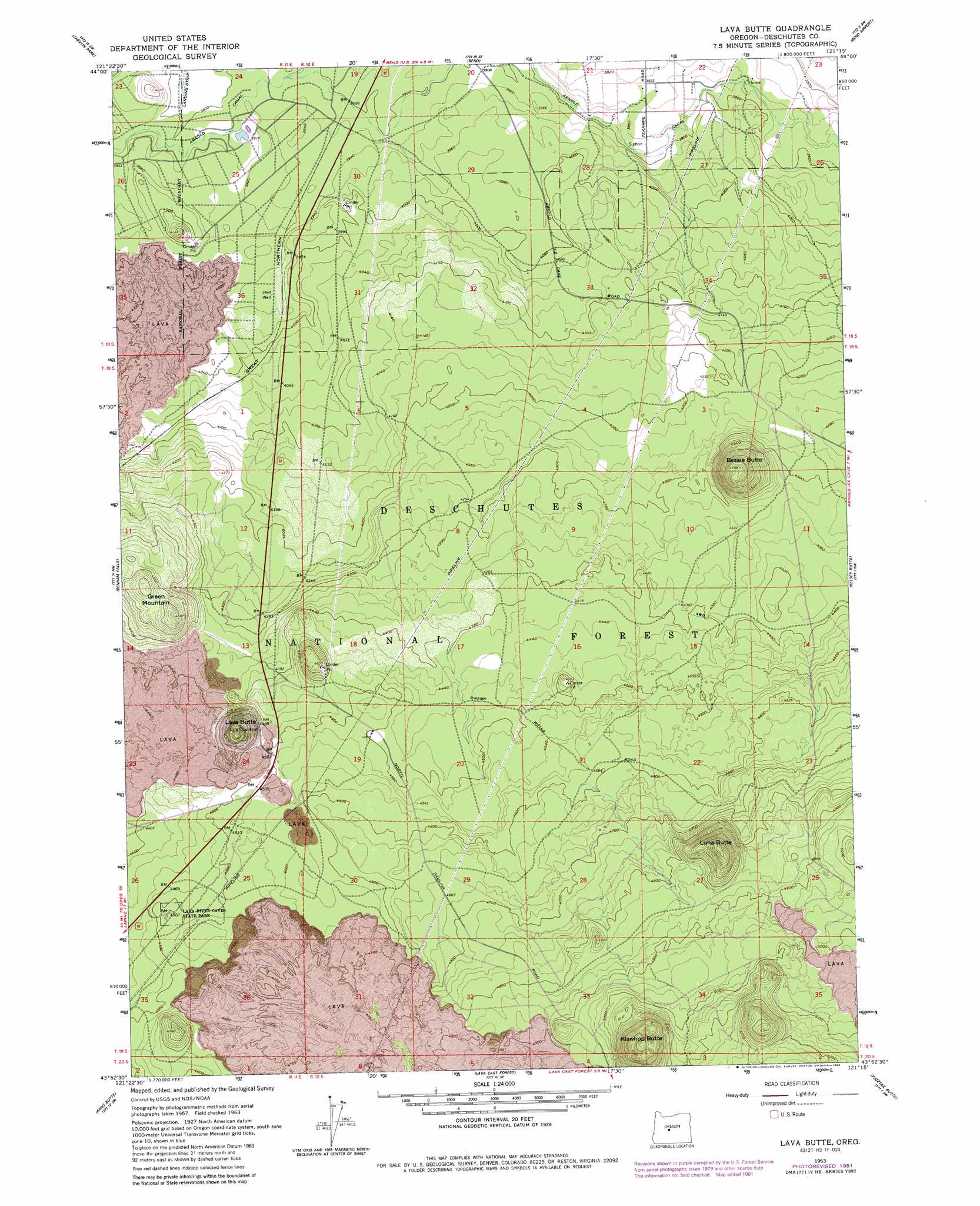
USGS Topo Quad 43121h3 - 1:24,000 scale
| Topo Map Name: | Lava Butte |
| USGS Topo Quad ID: | 43121h3 |
| Print Size: | ca. 21 1/4" wide x 27" high |
| Southeast Coordinates: | 43.875° N latitude / 121.25° W longitude |
| Map Center Coordinates: | 43.9375° N latitude / 121.3125° W longitude |
| U.S. State: | OR |
| Filename: | o43121h3.jpg |
| Download Map JPG Image: | Lava Butte topo map 1:24,000 scale |
| Map Type: | Topographic |
| Topo Series: | 7.5´ |
| Map Scale: | 1:24,000 |
| Source of Map Images: | United States Geological Survey (USGS) |
| Alternate Map Versions: |
Lava Butte OR 1963, updated 1964 Download PDF Buy paper map Lava Butte OR 1963, updated 1979 Download PDF Buy paper map Lava Butte OR 1963, updated 1981 Download PDF Buy paper map Lava Butte OR 1963, updated 1986 Download PDF Buy paper map Lava Butte OR 2011 Download PDF Buy paper map Lava Butte OR 2014 Download PDF Buy paper map |
| FStopo: | US Forest Service topo Lava Butte is available: Download FStopo PDF Download FStopo TIF |
1:24,000 Topo Quads surrounding Lava Butte
Three Creek Butte |
Tumalo Dam |
Tumalo |
Forked Horn Butte |
Powell Butte |
Tumalo Falls |
Shevlin Park |
Bend |
Bend Airport |
Alfalfa |
Wanoga Butte |
Benham Falls |
Lava Butte |
Kelsey Butte |
Horse Ridge |
Pistol Butte |
Anns Butte |
Lava Cast Forest |
Fuzztail Butte |
Evans Well |
La Pine |
Finley Butte |
Paulina Peak |
East Lake |
China Hat |
> Back to 43121e1 at 1:100,000 scale
> Back to 43120a1 at 1:250,000 scale
> Back to U.S. Topo Maps home
Lava Butte topo map: Gazetteer
Lava Butte: Canals
Arnold Canal elevation 1194m 3917′Lava Butte: Lakes
Baker Lake elevation 1194m 3917′Lava Butte: Populated Places
Deschutes River Woods elevation 1195m 3920′Lava Butte digital topo map on disk
Buy this Lava Butte topo map showing relief, roads, GPS coordinates and other geographical features, as a high-resolution digital map file on DVD: