Benham Falls Topo Map Oregon
To zoom in, hover over the map of Benham Falls
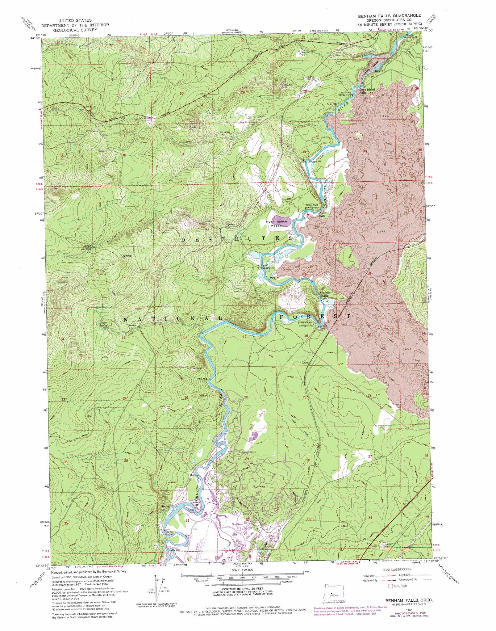
USGS Topo Quad 43121h4 - 1:24,000 scale
| Topo Map Name: | Benham Falls |
| USGS Topo Quad ID: | 43121h4 |
| Print Size: | ca. 21 1/4" wide x 27" high |
| Southeast Coordinates: | 43.875° N latitude / 121.375° W longitude |
| Map Center Coordinates: | 43.9375° N latitude / 121.4375° W longitude |
| U.S. State: | OR |
| Filename: | o43121h4.jpg |
| Download Map JPG Image: | Benham Falls topo map 1:24,000 scale |
| Map Type: | Topographic |
| Topo Series: | 7.5´ |
| Map Scale: | 1:24,000 |
| Source of Map Images: | United States Geological Survey (USGS) |
| Alternate Map Versions: |
Benham Falls OR 1963, updated 1964 Download PDF Buy paper map Benham Falls OR 1963, updated 1981 Download PDF Buy paper map Benham Falls OR 2011 Download PDF Buy paper map Benham Falls OR 2014 Download PDF Buy paper map |
| FStopo: | US Forest Service topo Benham Falls is available: Download FStopo PDF Download FStopo TIF |
1:24,000 Topo Quads surrounding Benham Falls
Trout Creek Butte |
Three Creek Butte |
Tumalo Dam |
Tumalo |
Forked Horn Butte |
Lake Geneva |
Tumalo Falls |
Shevlin Park |
Bend |
Bend Airport |
Bachelor Butte |
Wanoga Butte |
Benham Falls |
Lava Butte |
Kelsey Butte |
Round Mountain |
Pistol Butte |
Anns Butte |
Lava Cast Forest |
Fuzztail Butte |
Wickiup Dam |
La Pine |
Finley Butte |
Paulina Peak |
East Lake |
> Back to 43121e1 at 1:100,000 scale
> Back to 43120a1 at 1:250,000 scale
> Back to U.S. Topo Maps home
Benham Falls topo map: Gazetteer
Benham Falls: Areas
Lava Butte Geological Area (historical) elevation 1263m 4143′Benham Falls: Falls
Benham Falls elevation 1266m 4153′Dillon Falls elevation 1233m 4045′
Lava Island Falls elevation 1197m 3927′
Upper Falls Deschutes River elevation 1204m 3950′
Benham Falls: Flats
Ryan Ranch Meadow elevation 1230m 4035′Benham Falls: Lavas
Lava Island elevation 1191m 3907′Benham Falls: Populated Places
Sunriver elevation 1271m 4169′Benham Falls: Post Offices
Sunriver Post Office elevation 1271m 4169′Benham Falls: Springs
Coyote Spring elevation 1418m 4652′Kiwa Springs elevation 1459m 4786′
Benham Falls digital topo map on disk
Buy this Benham Falls topo map showing relief, roads, GPS coordinates and other geographical features, as a high-resolution digital map file on DVD: