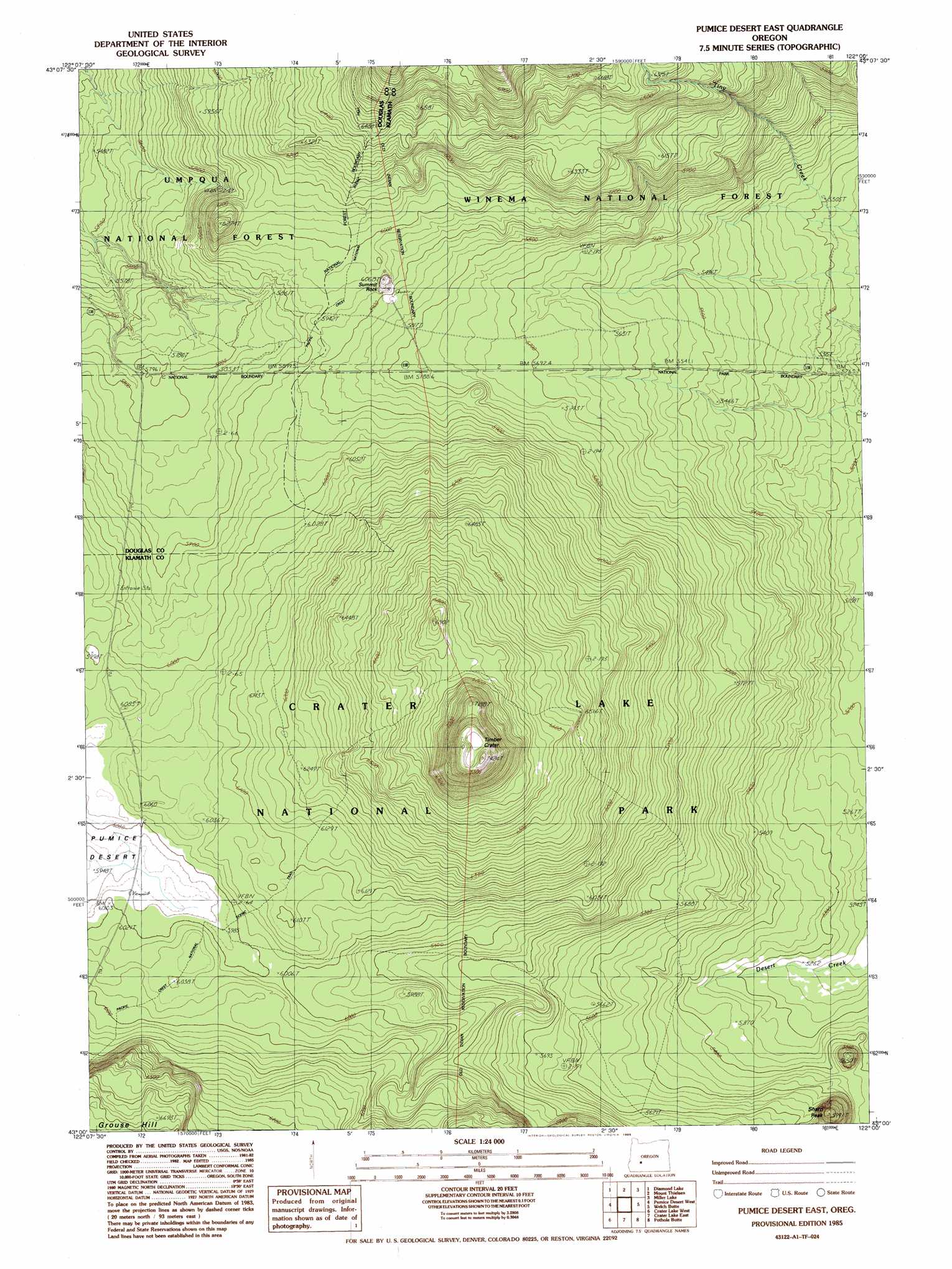
Pumice Desert East Topo Map Oregon
To zoom in, hover over the map of Pumice Desert East
USGS Topo Quad 43122a1 - 1:24,000 scale
| Topo Map Name: | Pumice Desert East |
| USGS Topo Quad ID: | 43122a1 |
| Print Size: | ca. 21 1/4" wide x 27" high |
| Southeast Coordinates: | 43° N latitude / 122° W longitude |
| Map Center Coordinates: | 43.0625° N latitude / 122.0625° W longitude |
| U.S. State: | OR |
| Filename: | o43122a1.jpg |
| Download Map JPG Image: | Pumice Desert East topo map 1:24,000 scale |
| Map Type: | Topographic |
| Topo Series: | 7.5´ |
| Map Scale: | 1:24,000 |
| Source of Map Images: | United States Geological Survey (USGS) |
| Alternate Map Versions: |
Pumice Desert East OR 1985, updated 1985 Download PDF Buy paper map Pumice Desert East OR 1999, updated 2002 Download PDF Buy paper map Pumice Desert East OR 2011 Download PDF Buy paper map Pumice Desert East OR 2014 Download PDF Buy paper map |
| FStopo: | US Forest Service topo Pumice Desert East is available: Download FStopo PDF Download FStopo TIF |
1:24,000 Topo Quads surrounding Pumice Desert East
Potter Mountain |
Lemolo Lake |
Tolo Mountain |
Burn Butte |
Muttonchop Butte |
Garwood Butte |
Diamond Lake |
Mount Thielsen |
Miller Lake |
Chemult |
Hamaker Butte |
Pumice Desert West |
Pumice Desert East |
Welch Butte |
Mazama |
Thousand Springs |
Crater Lake West |
Crater Lake East |
Pothole Butte |
Lenz |
Red Blanket Mountain |
Union Peak |
Maklaks Crater |
Sun Pass |
Fuego |
> Back to 43122a1 at 1:100,000 scale
> Back to 43122a1 at 1:250,000 scale
> Back to U.S. Topo Maps home
Pumice Desert East topo map: Gazetteer
Pumice Desert East: Craters
Timber Crater elevation 2231m 7319′Pumice Desert East: Pillars
Summit Rock elevation 1828m 5997′Pumice Desert East: Summits
Sharp Peak elevation 1809m 5935′Pumice Desert East digital topo map on disk
Buy this Pumice Desert East topo map showing relief, roads, GPS coordinates and other geographical features, as a high-resolution digital map file on DVD: