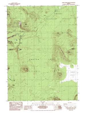
Pumice Desert West Topo Map Oregon
To zoom in, hover over the map of Pumice Desert West
USGS Topo Quad 43122a2 - 1:24,000 scale
| Topo Map Name: | Pumice Desert West |
| USGS Topo Quad ID: | 43122a2 |
| Print Size: | ca. 21 1/4" wide x 27" high |
| Southeast Coordinates: | 43° N latitude / 122.125° W longitude |
| Map Center Coordinates: | 43.0625° N latitude / 122.1875° W longitude |
| U.S. State: | OR |
| Filename: | o43122a2.jpg |
| Download Map JPG Image: | Pumice Desert West topo map 1:24,000 scale |
| Map Type: | Topographic |
| Topo Series: | 7.5´ |
| Map Scale: | 1:24,000 |
| Source of Map Images: | United States Geological Survey (USGS) |
| Alternate Map Versions: |
Pumice Desert West OR 1985, updated 1985 Download PDF Buy paper map Pumice Desert West OR 1998, updated 2000 Download PDF Buy paper map Pumice Desert West OR 2011 Download PDF Buy paper map Pumice Desert West OR 2014 Download PDF Buy paper map |
| FStopo: | US Forest Service topo Pumice Desert West is available: Download FStopo PDF Download FStopo TIF |
1:24,000 Topo Quads surrounding Pumice Desert West
> Back to 43122a1 at 1:100,000 scale
> Back to 43122a1 at 1:250,000 scale
> Back to U.S. Topo Maps home
Pumice Desert West topo map: Gazetteer
Pumice Desert West: Lakes
West Lake elevation 1562m 5124′Pumice Desert West: Plains
Pumice Desert elevation 1818m 5964′Pumice Desert West: Ridges
Desert Ridge elevation 2114m 6935′Klamath Ridge elevation 1899m 6230′
Pumice Desert West: Springs
Boundary Springs elevation 1614m 5295′Oasis Spring elevation 1645m 5396′
Pumice Desert West: Summits
Bald Crater elevation 1973m 6473′Desert Cone elevation 2030m 6660′
Gaywas Peak elevation 2054m 6738′
Oasis Butte elevation 1719m 5639′
Twin Knobs elevation 1878m 6161′
Pumice Desert West digital topo map on disk
Buy this Pumice Desert West topo map showing relief, roads, GPS coordinates and other geographical features, as a high-resolution digital map file on DVD:


