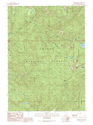
Buckeye Lake Topo Map Oregon
To zoom in, hover over the map of Buckeye Lake
USGS Topo Quad 43122a5 - 1:24,000 scale
| Topo Map Name: | Buckeye Lake |
| USGS Topo Quad ID: | 43122a5 |
| Print Size: | ca. 21 1/4" wide x 27" high |
| Southeast Coordinates: | 43° N latitude / 122.5° W longitude |
| Map Center Coordinates: | 43.0625° N latitude / 122.5625° W longitude |
| U.S. State: | OR |
| Filename: | o43122a5.jpg |
| Download Map JPG Image: | Buckeye Lake topo map 1:24,000 scale |
| Map Type: | Topographic |
| Topo Series: | 7.5´ |
| Map Scale: | 1:24,000 |
| Source of Map Images: | United States Geological Survey (USGS) |
| Alternate Map Versions: |
Buckeye Lake OR 1989, updated 1990 Download PDF Buy paper map Buckeye Lake OR 1998, updated 2000 Download PDF Buy paper map Buckeye Lake OR 2011 Download PDF Buy paper map Buckeye Lake OR 2014 Download PDF Buy paper map |
| FStopo: | US Forest Service topo Buckeye Lake is available: Download FStopo PDF Download FStopo TIF |
1:24,000 Topo Quads surrounding Buckeye Lake
> Back to 43122a1 at 1:100,000 scale
> Back to 43122a1 at 1:250,000 scale
> Back to U.S. Topo Maps home
Buckeye Lake topo map: Gazetteer
Buckeye Lake: Flats
Grasshopper Meadow elevation 1503m 4931′Buckeye Lake: Lakes
Alligator Lake elevation 886m 2906′Buckeye Lake elevation 1278m 4192′
Carmen Lake elevation 741m 2431′
Castor Lake elevation 704m 2309′
Cliff Lake elevation 1301m 4268′
Fish Lake elevation 1028m 3372′
Little Fish Lake elevation 1300m 4265′
Skookum Pond elevation 1066m 3497′
Buckeye Lake: Springs
Buster Spring elevation 928m 3044′Grasshopper Spring elevation 1573m 5160′
Sadie Spring elevation 1154m 3786′
Buckeye Lake: Streams
Black Rock Fork elevation 613m 2011′Castle Rock Fork elevation 613m 2011′
Emerson Creek elevation 569m 1866′
Fish Lake Creek elevation 636m 2086′
Lonewoman Creek elevation 880m 2887′
Mink Creek elevation 751m 2463′
Silver Creek elevation 612m 2007′
Skillet Creek elevation 575m 1886′
Skimmerhorn Creek elevation 689m 2260′
West Fork Skimmerhorn Creek elevation 704m 2309′
Buckeye Lake: Summits
Grasshopper Mountain elevation 1674m 5492′Buckeye Lake: Swamps
Beaver Swamp elevation 939m 3080′Buckeye Lake: Trails
Acker Divide Trail elevation 1308m 4291′Jackson Creek Trail elevation 1302m 4271′
Buckeye Lake digital topo map on disk
Buy this Buckeye Lake topo map showing relief, roads, GPS coordinates and other geographical features, as a high-resolution digital map file on DVD:


