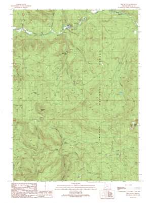
Red Butte Topo Map Oregon
To zoom in, hover over the map of Red Butte
USGS Topo Quad 43122b8 - 1:24,000 scale
| Topo Map Name: | Red Butte |
| USGS Topo Quad ID: | 43122b8 |
| Print Size: | ca. 21 1/4" wide x 27" high |
| Southeast Coordinates: | 43.125° N latitude / 122.875° W longitude |
| Map Center Coordinates: | 43.1875° N latitude / 122.9375° W longitude |
| U.S. State: | OR |
| Filename: | o43122b8.jpg |
| Download Map JPG Image: | Red Butte topo map 1:24,000 scale |
| Map Type: | Topographic |
| Topo Series: | 7.5´ |
| Map Scale: | 1:24,000 |
| Source of Map Images: | United States Geological Survey (USGS) |
| Alternate Map Versions: |
Red Butte OR 1989, updated 1990 Download PDF Buy paper map Red Butte OR 1997, updated 2000 Download PDF Buy paper map Red Butte OR 2011 Download PDF Buy paper map Red Butte OR 2014 Download PDF Buy paper map |
| FStopo: | US Forest Service topo Red Butte is available: Download FStopo PDF Download FStopo TIF |
1:24,000 Topo Quads surrounding Red Butte
> Back to 43122a1 at 1:100,000 scale
> Back to 43122a1 at 1:250,000 scale
> Back to U.S. Topo Maps home
Red Butte topo map: Gazetteer
Red Butte: Falls
Shadow Falls elevation 634m 2080′Wolf Creek Falls elevation 590m 1935′
Red Butte: Flats
Sugar Pine Flat elevation 484m 1587′Red Butte: Gaps
Tanners Pass elevation 882m 2893′Red Butte: Lakes
Cavitt Lake elevation 1208m 3963′Red Butte: Parks
Emile Creek Recreation Site elevation 482m 1581′Red Butte: Ridges
Negro Ridge elevation 1089m 3572′Red Butte: Streams
Boundary Creek elevation 289m 948′Cultus Creek elevation 576m 1889′
Egglestron Creek elevation 361m 1184′
Emile Creek elevation 367m 1204′
Greenman Creek elevation 310m 1017′
Little Creek elevation 329m 1079′
Liveoak Creek elevation 484m 1587′
Negro Creek elevation 449m 1473′
Plusfour Creek elevation 547m 1794′
Shivigny Creek elevation 360m 1181′
Tuttle Creek elevation 456m 1496′
West Fork Wolf Creek elevation 461m 1512′
Withrow Creek elevation 662m 2171′
Wolf Creek elevation 327m 1072′
Red Butte: Summits
Red Butte elevation 1568m 5144′Sampson Butte elevation 1199m 3933′
Red Butte digital topo map on disk
Buy this Red Butte topo map showing relief, roads, GPS coordinates and other geographical features, as a high-resolution digital map file on DVD:


