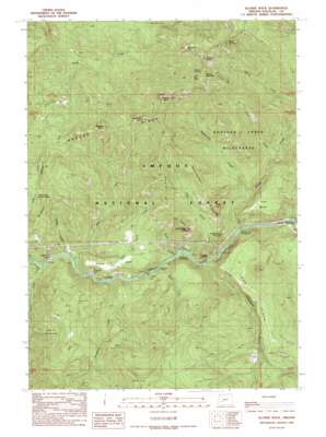
Illahee Rock Topo Map Oregon
To zoom in, hover over the map of Illahee Rock
USGS Topo Quad 43122c5 - 1:24,000 scale
| Topo Map Name: | Illahee Rock |
| USGS Topo Quad ID: | 43122c5 |
| Print Size: | ca. 21 1/4" wide x 27" high |
| Southeast Coordinates: | 43.25° N latitude / 122.5° W longitude |
| Map Center Coordinates: | 43.3125° N latitude / 122.5625° W longitude |
| U.S. State: | OR |
| Filename: | o43122c5.jpg |
| Download Map JPG Image: | Illahee Rock topo map 1:24,000 scale |
| Map Type: | Topographic |
| Topo Series: | 7.5´ |
| Map Scale: | 1:24,000 |
| Source of Map Images: | United States Geological Survey (USGS) |
| Alternate Map Versions: |
Illahee Rock OR 1989, updated 1990 Download PDF Buy paper map Illahee Rock OR 1997, updated 1999 Download PDF Buy paper map Illahee Rock OR 2011 Download PDF Buy paper map Illahee Rock OR 2014 Download PDF Buy paper map |
| FStopo: | US Forest Service topo Illahee Rock is available: Download FStopo PDF Download FStopo TIF |
1:24,000 Topo Quads surrounding Illahee Rock
> Back to 43122a1 at 1:100,000 scale
> Back to 43122a1 at 1:250,000 scale
> Back to U.S. Topo Maps home
Illahee Rock topo map: Gazetteer
Illahee Rock: Benches
Pine Bench elevation 797m 2614′Illahee Rock: Bridges
Marsters Bridge elevation 472m 1548′Illahee Rock: Capes
Charcoal Point elevation 463m 1519′Illahee Rock: Cliffs
Devils Stairway elevation 1445m 4740′Panther Leap elevation 577m 1893′
Illahee Rock: Flats
Hole in the Ground elevation 710m 2329′Horse Prairie elevation 1612m 5288′
Illahee Flats elevation 635m 2083′
Little Oak Flat elevation 559m 1833′
Oak Flats elevation 736m 2414′
Illahee Rock: Pillars
Illahee Rock elevation 1624m 5328′Old Man Rock elevation 859m 2818′
Rattlesnake Rock elevation 1117m 3664′
Illahee Rock: Ridges
Bear Point elevation 1569m 5147′Bradley Ridge elevation 1067m 3500′
Eagle Ridge elevation 1091m 3579′
Rattlesnake Ridge elevation 1126m 3694′
Illahee Rock: Springs
Illahee Spring elevation 1598m 5242′Illahee Rock: Streams
Boulder Creek elevation 500m 1640′Calf Creek elevation 431m 1414′
Copeland Creek elevation 485m 1591′
Deception Creek elevation 455m 1492′
Dry Creek elevation 443m 1453′
Dry Gulch Creek elevation 507m 1663′
Eagle Creek elevation 485m 1591′
Happy Creek elevation 453m 1486′
Onion Creek elevation 698m 2290′
Rattlesnake Creek elevation 600m 1968′
Wilson Creek elevation 483m 1584′
Illahee Rock: Summits
Bartrums Rock elevation 1392m 4566′Eagle Rock elevation 754m 2473′
Harding Butte elevation 1706m 5597′
Pine Point elevation 1098m 3602′
Quartz Point elevation 1127m 3697′
Ragged Butte elevation 1288m 4225′
Spring Mountain elevation 1635m 5364′
Wild Rose Point elevation 1616m 5301′
Illahee Rock: Trails
Deception Way elevation 577m 1893′Spring Mountain Way elevation 1286m 4219′
Illahee Rock: Valleys
Dark Canyon elevation 524m 1719′Illahee Rock digital topo map on disk
Buy this Illahee Rock topo map showing relief, roads, GPS coordinates and other geographical features, as a high-resolution digital map file on DVD:


