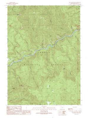
Mace Mountain Topo Map Oregon
To zoom in, hover over the map of Mace Mountain
USGS Topo Quad 43122c7 - 1:24,000 scale
| Topo Map Name: | Mace Mountain |
| USGS Topo Quad ID: | 43122c7 |
| Print Size: | ca. 21 1/4" wide x 27" high |
| Southeast Coordinates: | 43.25° N latitude / 122.75° W longitude |
| Map Center Coordinates: | 43.3125° N latitude / 122.8125° W longitude |
| U.S. State: | OR |
| Filename: | o43122c7.jpg |
| Download Map JPG Image: | Mace Mountain topo map 1:24,000 scale |
| Map Type: | Topographic |
| Topo Series: | 7.5´ |
| Map Scale: | 1:24,000 |
| Source of Map Images: | United States Geological Survey (USGS) |
| Alternate Map Versions: |
Mace Mountain OR 1989, updated 1990 Download PDF Buy paper map Mace Mountain OR 1997, updated 2000 Download PDF Buy paper map Mace Mountain OR 2011 Download PDF Buy paper map Mace Mountain OR 2014 Download PDF Buy paper map |
| FStopo: | US Forest Service topo Mace Mountain is available: Download FStopo PDF Download FStopo TIF |
1:24,000 Topo Quads surrounding Mace Mountain
> Back to 43122a1 at 1:100,000 scale
> Back to 43122a1 at 1:250,000 scale
> Back to U.S. Topo Maps home
Mace Mountain topo map: Gazetteer
Mace Mountain: Cliffs
Cougar Bluffs elevation 1211m 3973′Mace Mountain: Falls
Emile Falls elevation 802m 2631′Mace Mountain: Flats
Willow Flats elevation 1303m 4274′Mace Mountain: Streams
Alder Creek elevation 332m 1089′Archie Creek elevation 327m 1072′
Bogus Creek elevation 317m 1040′
Burnt Creek elevation 292m 958′
Cougar Creek elevation 336m 1102′
Fairview Creek elevation 305m 1000′
Fall Creek elevation 313m 1026′
Fisher Creek elevation 332m 1089′
Fox Creek elevation 278m 912′
John Creek elevation 312m 1023′
Raspberry Creek elevation 313m 1026′
Swamp Creek elevation 297m 974′
Thunder Creek elevation 307m 1007′
Timber Creek elevation 340m 1115′
Williams Creek elevation 331m 1085′
Wright Creek elevation 313m 1026′
Mace Mountain: Summits
Blitzen Butte elevation 1321m 4333′Gobblers Knob elevation 1365m 4478′
Mace Mountain elevation 1284m 4212′
Thunder Mountain elevation 1323m 4340′
Mace Mountain: Trails
Mott Trail elevation 545m 1788′Thunder Mountain Trail elevation 1324m 4343′
Williams Creek Trail elevation 884m 2900′
Mace Mountain digital topo map on disk
Buy this Mace Mountain topo map showing relief, roads, GPS coordinates and other geographical features, as a high-resolution digital map file on DVD:


