Old Fairview Topo Map Oregon
To zoom in, hover over the map of Old Fairview
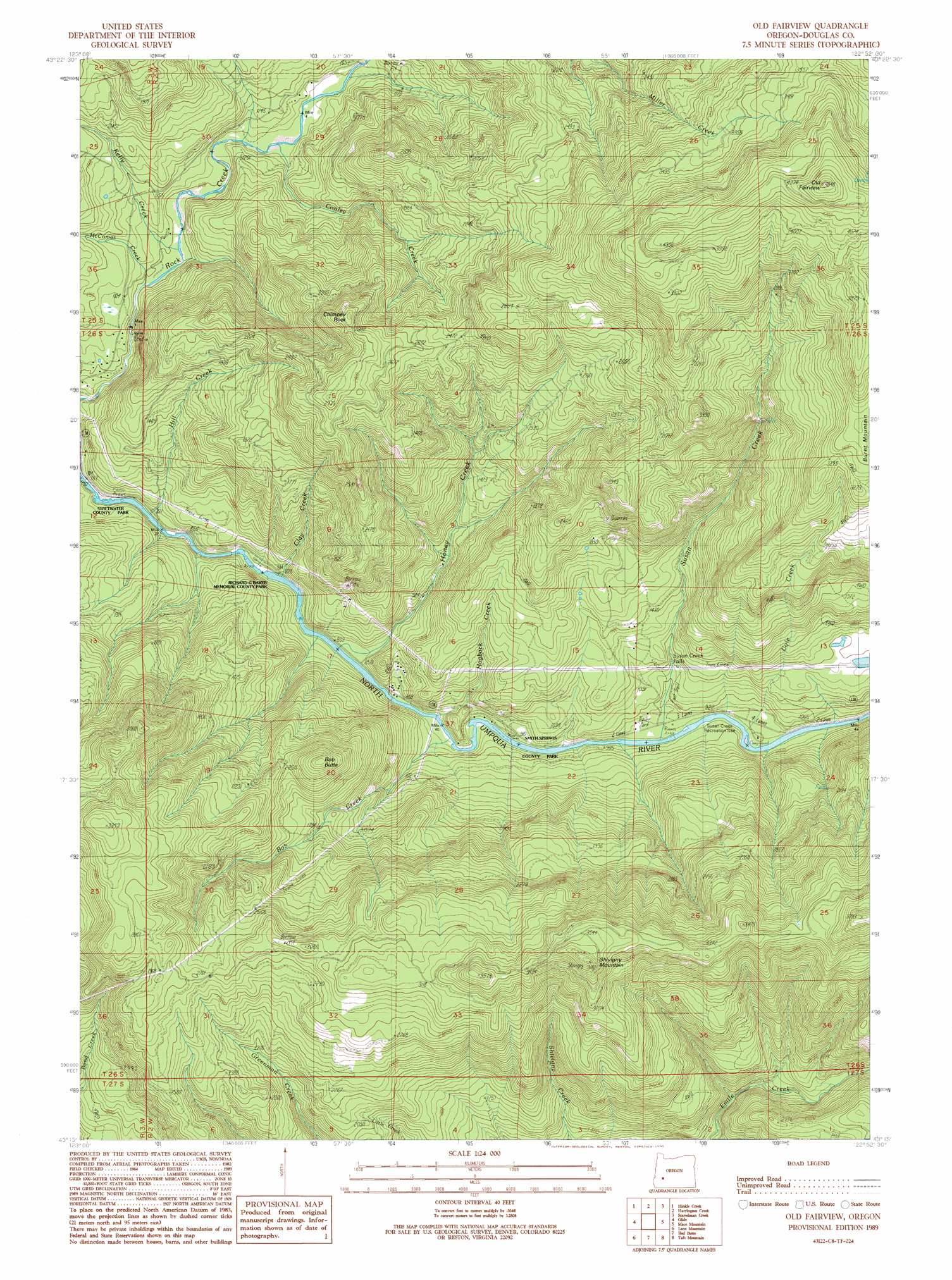
USGS Topo Quad 43122c8 - 1:24,000 scale
| Topo Map Name: | Old Fairview |
| USGS Topo Quad ID: | 43122c8 |
| Print Size: | ca. 21 1/4" wide x 27" high |
| Southeast Coordinates: | 43.25° N latitude / 122.875° W longitude |
| Map Center Coordinates: | 43.3125° N latitude / 122.9375° W longitude |
| U.S. State: | OR |
| Filename: | o43122c8.jpg |
| Download Map JPG Image: | Old Fairview topo map 1:24,000 scale |
| Map Type: | Topographic |
| Topo Series: | 7.5´ |
| Map Scale: | 1:24,000 |
| Source of Map Images: | United States Geological Survey (USGS) |
| Alternate Map Versions: |
Old Fairview OR 1989, updated 1990 Download PDF Buy paper map Old Fairview OR 1997, updated 2000 Download PDF Buy paper map Old Fairview OR 2011 Download PDF Buy paper map Old Fairview OR 2014 Download PDF Buy paper map |
| FStopo: | US Forest Service topo Old Fairview is available: Download FStopo PDF Download FStopo TIF |
1:24,000 Topo Quads surrounding Old Fairview
Scotts Valley |
Harness Mountain |
Burnt Mountain |
Silica Mountain |
Fairview Peak |
Nonpareil |
Hinkle Creek |
Harrington Creek |
Scaredman Creek |
Chilcoot Mountain |
Oak Creek Valley |
Glide |
Old Fairview |
Mace Mountain |
Steamboat |
Dixonville |
Lane Mountain |
Red Butte |
Taft Mountain |
Quartz Mountain |
Dodson Butte |
White Rock |
Deadman Mountain |
Dumont Creek |
Acker Rock |
> Back to 43122a1 at 1:100,000 scale
> Back to 43122a1 at 1:250,000 scale
> Back to U.S. Topo Maps home
Old Fairview topo map: Gazetteer
Old Fairview: Dams
Paris Dam elevation 422m 1384′Old Fairview: Falls
Susan Creek Falls elevation 658m 2158′Old Fairview: Parks
Richard G Baker Park elevation 327m 1072′Susan Creek Park (historical) elevation 277m 908′
Swiftwater Park elevation 321m 1053′
Old Fairview: Pillars
Chimney Rock elevation 892m 2926′Old Fairview: Populated Places
North Umpqua Village elevation 271m 889′Old Fairview: Reservoirs
Paris Reservoir elevation 422m 1384′Old Fairview: Streams
Bob Creek elevation 260m 853′Cedar Creek elevation 291m 954′
Clay Creek elevation 258m 846′
Cole Creek elevation 607m 1991′
Conley Creek elevation 313m 1026′
Hill Creek elevation 243m 797′
Hogback Creek elevation 266m 872′
Honey Creek elevation 259m 849′
Kelly Creek elevation 305m 1000′
McComas Creek elevation 304m 997′
Susan Creek elevation 269m 882′
Old Fairview: Summits
Bob Butte elevation 822m 2696′Burnt Mountain elevation 1047m 3435′
Old Fairview elevation 1407m 4616′
Shivigny Mountain elevation 1152m 3779′
Old Fairview digital topo map on disk
Buy this Old Fairview topo map showing relief, roads, GPS coordinates and other geographical features, as a high-resolution digital map file on DVD: