Harrington Creek Topo Map Oregon
To zoom in, hover over the map of Harrington Creek
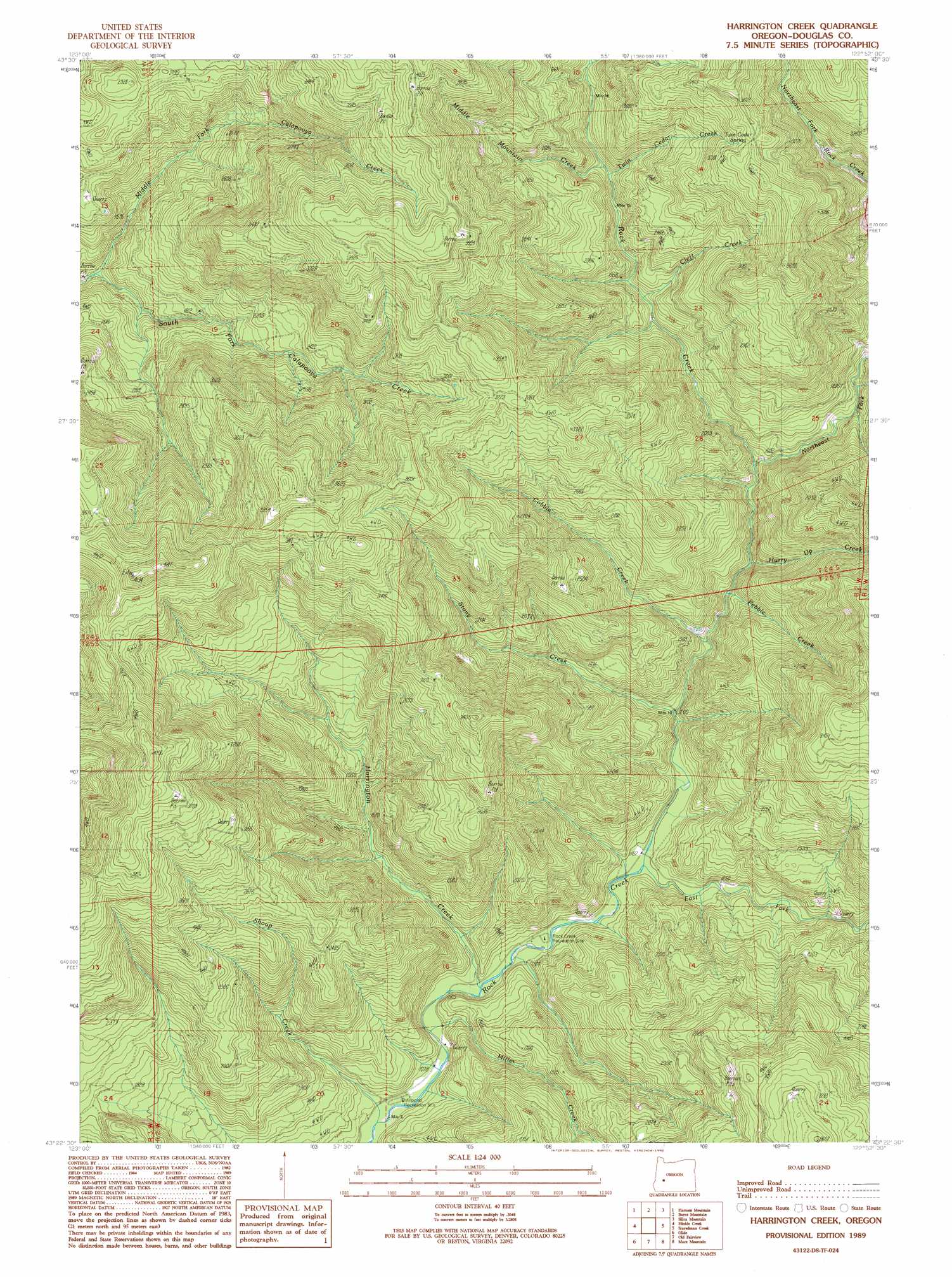
USGS Topo Quad 43122d8 - 1:24,000 scale
| Topo Map Name: | Harrington Creek |
| USGS Topo Quad ID: | 43122d8 |
| Print Size: | ca. 21 1/4" wide x 27" high |
| Southeast Coordinates: | 43.375° N latitude / 122.875° W longitude |
| Map Center Coordinates: | 43.4375° N latitude / 122.9375° W longitude |
| U.S. State: | OR |
| Filename: | o43122d8.jpg |
| Download Map JPG Image: | Harrington Creek topo map 1:24,000 scale |
| Map Type: | Topographic |
| Topo Series: | 7.5´ |
| Map Scale: | 1:24,000 |
| Source of Map Images: | United States Geological Survey (USGS) |
| Alternate Map Versions: |
Harrington Creek OR 1989, updated 1990 Download PDF Buy paper map Harrington Creek OR 2011 Download PDF Buy paper map Harrington Creek OR 2014 Download PDF Buy paper map |
1:24,000 Topo Quads surrounding Harrington Creek
Curtin |
Cottage Grove Lake |
Blue Mountain |
Culp Creek |
Rose Hill |
Scotts Valley |
Harness Mountain |
Burnt Mountain |
Silica Mountain |
Fairview Peak |
Nonpareil |
Hinkle Creek |
Harrington Creek |
Scaredman Creek |
Chilcoot Mountain |
Oak Creek Valley |
Glide |
Old Fairview |
Mace Mountain |
Steamboat |
Dixonville |
Lane Mountain |
Red Butte |
Taft Mountain |
Quartz Mountain |
> Back to 43122a1 at 1:100,000 scale
> Back to 43122a1 at 1:250,000 scale
> Back to U.S. Topo Maps home
Harrington Creek topo map: Gazetteer
Harrington Creek: Parks
Rock Creek Recreation Site elevation 353m 1158′Harrington Creek: Springs
Twin Cedar Spring elevation 1052m 3451′Harrington Creek: Streams
Cleft Creek elevation 586m 1922′Cobble Creek elevation 423m 1387′
East Fork Rock Creek elevation 368m 1207′
Harrington Creek elevation 345m 1131′
Huckleberry Creek elevation 668m 2191′
Hurry Up Creek elevation 442m 1450′
Middle Fork Calapooya Creek elevation 435m 1427′
Middle Mountain Creek elevation 667m 2188′
Miller Creek elevation 340m 1115′
Northeast Fork Rock Creek elevation 480m 1574′
Pebble Creek elevation 418m 1371′
Shoup Creek elevation 330m 1082′
Stony Creek elevation 385m 1263′
Twin Cedar Creek elevation 667m 2188′
Harrington Creek: Summits
Brown Mountain elevation 1254m 4114′Harrington Creek digital topo map on disk
Buy this Harrington Creek topo map showing relief, roads, GPS coordinates and other geographical features, as a high-resolution digital map file on DVD: