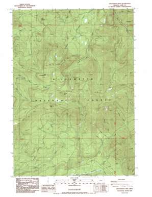
Groundhog Mountain Topo Map Oregon
To zoom in, hover over the map of Groundhog Mountain
USGS Topo Quad 43122e3 - 1:24,000 scale
| Topo Map Name: | Groundhog Mountain |
| USGS Topo Quad ID: | 43122e3 |
| Print Size: | ca. 21 1/4" wide x 27" high |
| Southeast Coordinates: | 43.5° N latitude / 122.25° W longitude |
| Map Center Coordinates: | 43.5625° N latitude / 122.3125° W longitude |
| U.S. State: | OR |
| Filename: | o43122e3.jpg |
| Download Map JPG Image: | Groundhog Mountain topo map 1:24,000 scale |
| Map Type: | Topographic |
| Topo Series: | 7.5´ |
| Map Scale: | 1:24,000 |
| Source of Map Images: | United States Geological Survey (USGS) |
| Alternate Map Versions: |
Groundhog Mountain OR 1986, updated 1986 Download PDF Buy paper map Groundhog Mountain OR 1997, updated 1998 Download PDF Buy paper map Groundhog Mountain OR 2011 Download PDF Buy paper map Groundhog Mountain OR 2014 Download PDF Buy paper map |
| FStopo: | US Forest Service topo Groundhog Mountain is available: Download FStopo PDF Download FStopo TIF |
1:24,000 Topo Quads surrounding Groundhog Mountain
> Back to 43122e1 at 1:100,000 scale
> Back to 43122a1 at 1:250,000 scale
> Back to U.S. Topo Maps home
Groundhog Mountain topo map: Gazetteer
Groundhog Mountain: Areas
Sharps Prairie elevation 955m 3133′Groundhog Mountain: Flats
Joes Prairie elevation 1558m 5111′Groundhog Mountain: Lakes
Waterdog Lake elevation 1634m 5360′Groundhog Mountain: Post Offices
Leader Post Office (historical) elevation 1106m 3628′Groundhog Mountain: Ridges
Juniper Ridge elevation 1658m 5439′Groundhog Mountain: Streams
Andy Creek elevation 867m 2844′Baboon Creek elevation 961m 3152′
Chako Creek elevation 848m 2782′
Coulee Creek elevation 866m 2841′
Found Creek elevation 789m 2588′
Mac Creek elevation 749m 2457′
Minnehaha Creek elevation 904m 2965′
Moss Creek elevation 1017m 3336′
Noisy Creek elevation 759m 2490′
North Fork Simpson Creek elevation 818m 2683′
Pool Creek elevation 984m 3228′
Skunk Creek elevation 781m 2562′
South Fork Simpson Creek elevation 1051m 3448′
Swift Creek elevation 767m 2516′
Tumbledown Creek elevation 920m 3018′
Wolf Creek elevation 999m 3277′
Groundhog Mountain: Summits
Buck Mountain elevation 1413m 4635′Groundhog Mountain elevation 1864m 6115′
Juniper Mountain elevation 1806m 5925′
Little Groundhog Mountain elevation 1801m 5908′
Logger Butte elevation 1749m 5738′
Groundhog Mountain: Trails
Bear Mountain Trail elevation 1532m 5026′Juniper Trail elevation 1722m 5649′
Swift Creek Trail elevation 989m 3244′
Groundhog Mountain digital topo map on disk
Buy this Groundhog Mountain topo map showing relief, roads, GPS coordinates and other geographical features, as a high-resolution digital map file on DVD:


