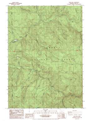
Rose Hill Topo Map Oregon
To zoom in, hover over the map of Rose Hill
USGS Topo Quad 43122f6 - 1:24,000 scale
| Topo Map Name: | Rose Hill |
| USGS Topo Quad ID: | 43122f6 |
| Print Size: | ca. 21 1/4" wide x 27" high |
| Southeast Coordinates: | 43.625° N latitude / 122.625° W longitude |
| Map Center Coordinates: | 43.6875° N latitude / 122.6875° W longitude |
| U.S. State: | OR |
| Filename: | o43122f6.jpg |
| Download Map JPG Image: | Rose Hill topo map 1:24,000 scale |
| Map Type: | Topographic |
| Topo Series: | 7.5´ |
| Map Scale: | 1:24,000 |
| Source of Map Images: | United States Geological Survey (USGS) |
| Alternate Map Versions: |
Rose Hill OR 1986, updated 1986 Download PDF Buy paper map Rose Hill OR 1998, updated 2000 Download PDF Buy paper map Rose Hill OR 2011 Download PDF Buy paper map Rose Hill OR 2014 Download PDF Buy paper map |
| FStopo: | US Forest Service topo Rose Hill is available: Download FStopo PDF Download FStopo TIF |
1:24,000 Topo Quads surrounding Rose Hill
> Back to 43122e1 at 1:100,000 scale
> Back to 43122a1 at 1:250,000 scale
> Back to U.S. Topo Maps home
Rose Hill topo map: Gazetteer
Rose Hill: Falls
Lower Trestle Creek Falls elevation 665m 2181′Spirit Falls elevation 591m 1938′
Upper Trestle Creek Falls elevation 788m 2585′
Rose Hill: Lakes
Crawfish Lake elevation 1219m 3999′Rose Hill: Mines
Green Rock Mine elevation 1191m 3907′Rose Hill: Post Offices
Bonita Post Office (historical) elevation 575m 1886′Rujada Post Office (historical) elevation 371m 1217′
Rose Hill: Ridges
Doris Ridge elevation 1026m 3366′Harvey Point elevation 762m 2500′
Kelly Ridge elevation 992m 3254′
Rujada Point elevation 902m 2959′
Rose Hill: Springs
Cedar Spring elevation 1177m 3861′Hotel Spring elevation 1132m 3713′
Rose Hill: Streams
Adams Creek elevation 444m 1456′Alex Creek elevation 525m 1722′
Blodgett Creek elevation 407m 1335′
Cat Creek elevation 651m 2135′
Cedar Creek elevation 457m 1499′
Champion Creek elevation 589m 1932′
Crawfish Creek elevation 475m 1558′
Curran Creek elevation 475m 1558′
Dinner Creek elevation 417m 1368′
Dog Creek elevation 495m 1624′
Donna Creek elevation 458m 1502′
Doris Creek elevation 473m 1551′
East Fork Layng Creek elevation 709m 2326′
East Fork Prather Creek elevation 415m 1361′
Harvey Creek elevation 463m 1519′
Herman Creek elevation 474m 1555′
Hobo Creek elevation 527m 1729′
Inch Creek elevation 522m 1712′
Junetta Creek elevation 428m 1404′
Marten Creek elevation 536m 1758′
Patterson Creek elevation 488m 1601′
Prather Creek elevation 380m 1246′
Saltpeter Creek elevation 531m 1742′
Silverstairs Creek elevation 659m 2162′
Trestle Creek elevation 614m 2014′
West Fork Prather Creek elevation 453m 1486′
Rose Hill: Summits
Rose Hill elevation 978m 3208′Rose Hill digital topo map on disk
Buy this Rose Hill topo map showing relief, roads, GPS coordinates and other geographical features, as a high-resolution digital map file on DVD:


