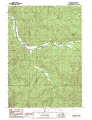
Culp Creek Topo Map Oregon
To zoom in, hover over the map of Culp Creek
USGS Topo Quad 43122f7 - 1:24,000 scale
| Topo Map Name: | Culp Creek |
| USGS Topo Quad ID: | 43122f7 |
| Print Size: | ca. 21 1/4" wide x 27" high |
| Southeast Coordinates: | 43.625° N latitude / 122.75° W longitude |
| Map Center Coordinates: | 43.6875° N latitude / 122.8125° W longitude |
| U.S. State: | OR |
| Filename: | o43122f7.jpg |
| Download Map JPG Image: | Culp Creek topo map 1:24,000 scale |
| Map Type: | Topographic |
| Topo Series: | 7.5´ |
| Map Scale: | 1:24,000 |
| Source of Map Images: | United States Geological Survey (USGS) |
| Alternate Map Versions: |
Culp Creek OR 1986, updated 1986 Download PDF Buy paper map Culp Creek OR 2011 Download PDF Buy paper map Culp Creek OR 2014 Download PDF Buy paper map |
| FStopo: | US Forest Service topo Culp Creek is available: Download FStopo PDF Download FStopo TIF |
1:24,000 Topo Quads surrounding Culp Creek
> Back to 43122e1 at 1:100,000 scale
> Back to 43122a1 at 1:250,000 scale
> Back to U.S. Topo Maps home
Culp Creek topo map: Gazetteer
Culp Creek: Areas
Sharps Creek Recreation Area elevation 395m 1295′Culp Creek: Bridges
Pony Bridge elevation 352m 1154′Staples Covered Bridge elevation 386m 1266′
Culp Creek: Falls
Wildwood Falls elevation 306m 1003′Culp Creek: Parks
Lasells D Stewart County Park elevation 307m 1007′Sharps Creek Wayside elevation 378m 1240′
Wildwood Falls County Park elevation 327m 1072′
Culp Creek: Populated Places
Culp Creek elevation 293m 961′Disston elevation 351m 1151′
Dorena elevation 281m 921′
Culp Creek: Post Offices
Bluff Post Office (historical) elevation 316m 1036′Culp Creek Post Office elevation 293m 961′
Disston Post Office (historical) elevation 351m 1151′
Dorena Post Office elevation 281m 921′
Star Post Office (historical) elevation 284m 931′
Wildwood Post Office (historical) elevation 325m 1066′
Culp Creek: Streams
Alder Creek elevation 383m 1256′Boulder Creek elevation 308m 1010′
Brice Creek elevation 337m 1105′
Culp Creek elevation 299m 980′
Damewood Creek elevation 316m 1036′
Gleason Creek elevation 323m 1059′
Hawley Creek elevation 283m 928′
Hunt Creek elevation 324m 1062′
Layng Creek elevation 343m 1125′
Pitcher Creek elevation 353m 1158′
Pony Creek elevation 358m 1174′
Sallee Creek elevation 266m 872′
Sharps Creek elevation 292m 958′
Spring Brook elevation 333m 1092′
Staples Creek elevation 386m 1266′
Table Creek elevation 322m 1056′
Wee Creek elevation 379m 1243′
Culp Creek: Summits
Green Mountain elevation 1049m 3441′Hawley Butte elevation 912m 2992′
Table Mountain elevation 1274m 4179′
Culp Creek digital topo map on disk
Buy this Culp Creek topo map showing relief, roads, GPS coordinates and other geographical features, as a high-resolution digital map file on DVD:


