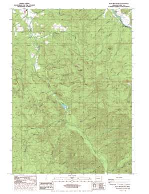
Blue Mountain Topo Map Oregon
To zoom in, hover over the map of Blue Mountain
USGS Topo Quad 43122f8 - 1:24,000 scale
| Topo Map Name: | Blue Mountain |
| USGS Topo Quad ID: | 43122f8 |
| Print Size: | ca. 21 1/4" wide x 27" high |
| Southeast Coordinates: | 43.625° N latitude / 122.875° W longitude |
| Map Center Coordinates: | 43.6875° N latitude / 122.9375° W longitude |
| U.S. State: | OR |
| Filename: | o43122f8.jpg |
| Download Map JPG Image: | Blue Mountain topo map 1:24,000 scale |
| Map Type: | Topographic |
| Topo Series: | 7.5´ |
| Map Scale: | 1:24,000 |
| Source of Map Images: | United States Geological Survey (USGS) |
| Alternate Map Versions: |
Blue Mountain OR 1986, updated 1986 Download PDF Buy paper map Blue Mountain OR 2011 Download PDF Buy paper map Blue Mountain OR 2014 Download PDF Buy paper map |
1:24,000 Topo Quads surrounding Blue Mountain
> Back to 43122e1 at 1:100,000 scale
> Back to 43122a1 at 1:250,000 scale
> Back to U.S. Topo Maps home
Blue Mountain topo map: Gazetteer
Blue Mountain: Bridges
Dorena Bridge elevation 257m 843′Blue Mountain: Dams
Booth-Kelly Lumber Company Log Pond Dike elevation 289m 948′Blue Mountain: Parks
Blue Mountain County Park elevation 241m 790′Vaughn County Park elevation 262m 859′
Blue Mountain: Pillars
Big Rock elevation 1017m 3336′Blue Rock elevation 854m 2801′
Blue Mountain: Post Offices
Row River Post Office (historical) elevation 266m 872′Blue Mountain: Reservoirs
Booth-Kelly Lumber Company Log Pond elevation 289m 948′Blue Mountain: Streams
Allen Creek elevation 334m 1095′Anderson Creek elevation 257m 843′
Blue Creek elevation 273m 895′
Cedar Creek elevation 327m 1072′
Clearing Creek elevation 322m 1056′
Cow Creek elevation 313m 1026′
Fall Creek elevation 270m 885′
Kennedy Creek elevation 256m 839′
King Creek elevation 257m 843′
Kizer Creek elevation 220m 721′
Lewis Creek elevation 293m 961′
North Fork Rock Creek elevation 375m 1230′
North Fork Stell Creek elevation 375m 1230′
Palmer Creek elevation 311m 1020′
Perkins Creek elevation 237m 777′
Pitcher Creek elevation 272m 892′
Rock Creek elevation 300m 984′
Short Creek elevation 287m 941′
Simpson Creek elevation 276m 905′
Smith Creek elevation 257m 843′
South Fork Rock Creek elevation 375m 1230′
Stell Creek elevation 334m 1095′
Table Rock Creek elevation 402m 1318′
Blue Mountain: Summits
Blue Mountain elevation 919m 3015′Round Mountain elevation 631m 2070′
Blue Mountain: Trails
Windfall Adverse elevation 648m 2125′Blue Mountain digital topo map on disk
Buy this Blue Mountain topo map showing relief, roads, GPS coordinates and other geographical features, as a high-resolution digital map file on DVD:


