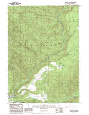
Westfir East Topo Map Oregon
To zoom in, hover over the map of Westfir East
USGS Topo Quad 43122g4 - 1:24,000 scale
| Topo Map Name: | Westfir East |
| USGS Topo Quad ID: | 43122g4 |
| Print Size: | ca. 21 1/4" wide x 27" high |
| Southeast Coordinates: | 43.75° N latitude / 122.375° W longitude |
| Map Center Coordinates: | 43.8125° N latitude / 122.4375° W longitude |
| U.S. State: | OR |
| Filename: | o43122g4.jpg |
| Download Map JPG Image: | Westfir East topo map 1:24,000 scale |
| Map Type: | Topographic |
| Topo Series: | 7.5´ |
| Map Scale: | 1:24,000 |
| Source of Map Images: | United States Geological Survey (USGS) |
| Alternate Map Versions: |
Westfir East OR 1986, updated 1986 Download PDF Buy paper map Westfir East OR 1997, updated 1998 Download PDF Buy paper map Westfir East OR 2011 Download PDF Buy paper map Westfir East OR 2014 Download PDF Buy paper map |
| FStopo: | US Forest Service topo Westfir East is available: Download FStopo PDF Download FStopo TIF |
1:24,000 Topo Quads surrounding Westfir East
> Back to 43122e1 at 1:100,000 scale
> Back to 43122a1 at 1:250,000 scale
> Back to U.S. Topo Maps home
Westfir East topo map: Gazetteer
Westfir East: Bridges
Office Bridge elevation 326m 1069′Westfir East: Dams
Dam Number One elevation 326m 1069′Westfir East: Flats
High Prairie elevation 670m 2198′Westfir East: Gaps
Windy Pass elevation 1136m 3727′Westfir East: Lakes
Scout Lake elevation 579m 1899′Westfir East: Populated Places
Westfir elevation 327m 1072′Westfir East: Post Offices
Big Prairie Post Office (historical) elevation 333m 1092′Westfir Post Office elevation 327m 1072′
Westfir East: Reservoirs
Catching Reservoir elevation 326m 1069′Westfir East: Streams
Chalk Creek elevation 508m 1666′Dartmouth Creek elevation 366m 1200′
Eighth Creek elevation 408m 1338′
Fifth Creek elevation 744m 2440′
First Creek elevation 370m 1213′
Fourth Creek elevation 664m 2178′
Hamner Creek elevation 450m 1476′
High Creek elevation 427m 1400′
Huckleberry Creek elevation 375m 1230′
Leapfrog Creek elevation 431m 1414′
Maple Creek elevation 439m 1440′
McKinley Creek elevation 458m 1502′
McLane Creek elevation 327m 1072′
Ninth Creek elevation 419m 1374′
Salal Creek elevation 812m 2664′
Second Creek elevation 715m 2345′
Seventh Creek elevation 737m 2417′
Short Creek elevation 353m 1158′
Sixth Creek elevation 766m 2513′
Slide Creek elevation 429m 1407′
Third Creek elevation 554m 1817′
Westfir East: Summits
Buckhead Mountain elevation 991m 3251′Dead Mountain elevation 1139m 3736′
Sourgrass Mountain elevation 1458m 4783′
Westfir East: Trails
Alpine Trail elevation 1173m 3848′Cain Cabin Trail elevation 957m 3139′
Hamner Creek Way elevation 939m 3080′
Westfir East digital topo map on disk
Buy this Westfir East topo map showing relief, roads, GPS coordinates and other geographical features, as a high-resolution digital map file on DVD:


