Kloster Mountain Topo Map Oregon
To zoom in, hover over the map of Kloster Mountain
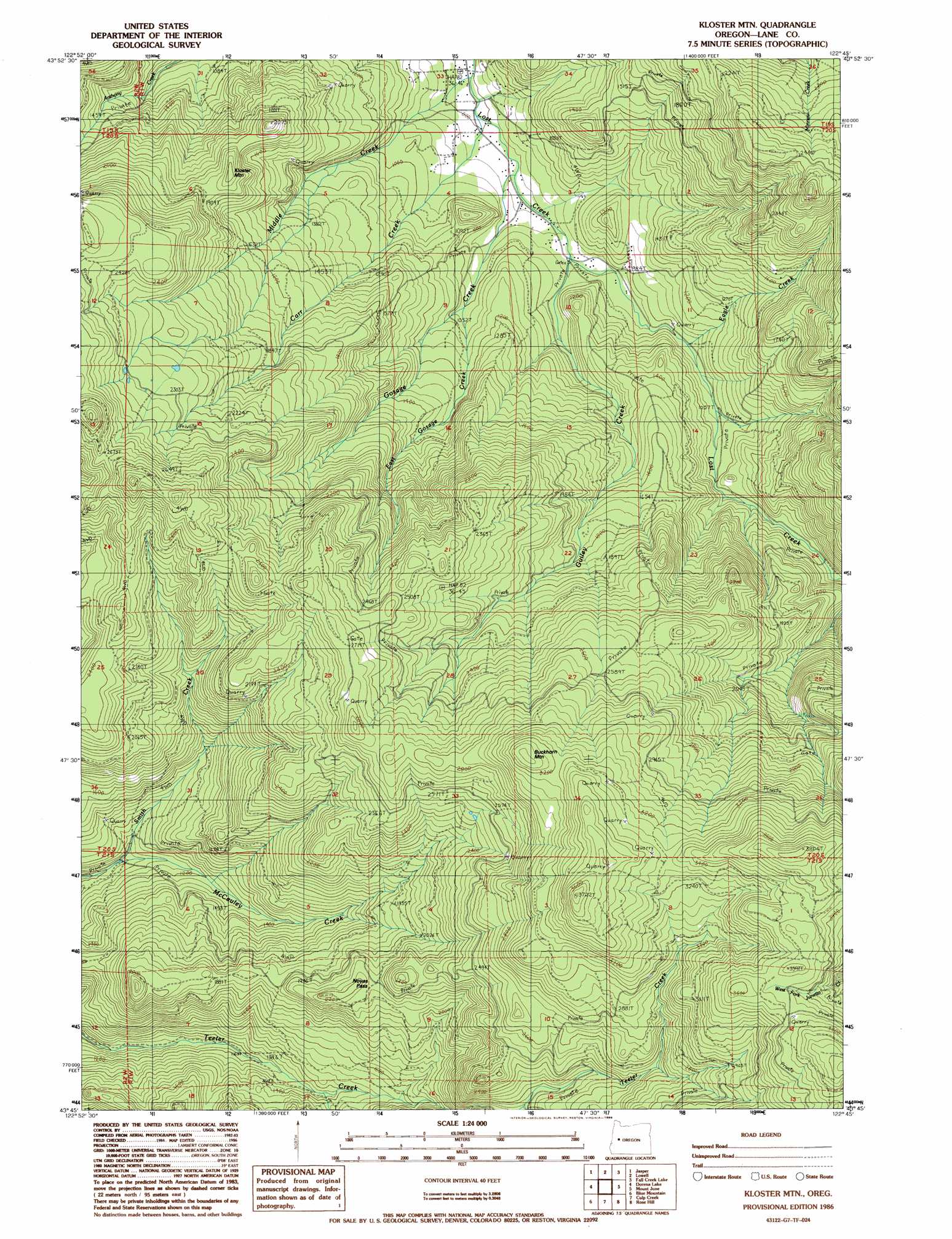
USGS Topo Quad 43122g7 - 1:24,000 scale
| Topo Map Name: | Kloster Mountain |
| USGS Topo Quad ID: | 43122g7 |
| Print Size: | ca. 21 1/4" wide x 27" high |
| Southeast Coordinates: | 43.75° N latitude / 122.75° W longitude |
| Map Center Coordinates: | 43.8125° N latitude / 122.8125° W longitude |
| U.S. State: | OR |
| Filename: | o43122g7.jpg |
| Download Map JPG Image: | Kloster Mountain topo map 1:24,000 scale |
| Map Type: | Topographic |
| Topo Series: | 7.5´ |
| Map Scale: | 1:24,000 |
| Source of Map Images: | United States Geological Survey (USGS) |
| Alternate Map Versions: |
Kloster Mtn OR 1986, updated 1986 Download PDF Buy paper map Kloster Mountain OR 2011 Download PDF Buy paper map Kloster Mountain OR 2014 Download PDF Buy paper map |
1:24,000 Topo Quads surrounding Kloster Mountain
Eugene East |
Springfield |
Walterville |
Leaburg |
Goat Mountain |
Creswell |
Jasper |
Lowell |
Fall Creek Lake |
Saddleblanket Mountain |
Cottage Grove |
Dorena Lake |
Kloster Mountain |
Mount June |
Westfir West |
Cottage Grove Lake |
Blue Mountain |
Culp Creek |
Rose Hill |
Holland Point |
Harness Mountain |
Burnt Mountain |
Silica Mountain |
Fairview Peak |
Bearbones Mountain |
> Back to 43122e1 at 1:100,000 scale
> Back to 43122a1 at 1:250,000 scale
> Back to U.S. Topo Maps home
Kloster Mountain topo map: Gazetteer
Kloster Mountain: Gaps
Noyas Pass elevation 652m 2139′Kloster Mountain: Populated Places
Wildwood elevation 629m 2063′Kloster Mountain: Streams
Carr Creek elevation 243m 797′Eagle Creek elevation 312m 1023′
East Gosage Creek elevation 314m 1030′
Gosage Creek elevation 254m 833′
Guiley Creek elevation 281m 921′
McCauley Creek elevation 318m 1043′
Middle Creek elevation 247m 810′
Kloster Mountain: Summits
Buckhorn Mountain elevation 1016m 3333′Kloster Mountain elevation 623m 2043′
Kloster Mountain: Trails
Teeter Creek Loop elevation 1063m 3487′Kloster Mountain digital topo map on disk
Buy this Kloster Mountain topo map showing relief, roads, GPS coordinates and other geographical features, as a high-resolution digital map file on DVD: