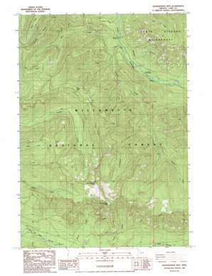
Grasshopper Mountain Topo Map Oregon
To zoom in, hover over the map of Grasshopper Mountain
USGS Topo Quad 43122h2 - 1:24,000 scale
| Topo Map Name: | Grasshopper Mountain |
| USGS Topo Quad ID: | 43122h2 |
| Print Size: | ca. 21 1/4" wide x 27" high |
| Southeast Coordinates: | 43.875° N latitude / 122.125° W longitude |
| Map Center Coordinates: | 43.9375° N latitude / 122.1875° W longitude |
| U.S. State: | OR |
| Filename: | o43122h2.jpg |
| Download Map JPG Image: | Grasshopper Mountain topo map 1:24,000 scale |
| Map Type: | Topographic |
| Topo Series: | 7.5´ |
| Map Scale: | 1:24,000 |
| Source of Map Images: | United States Geological Survey (USGS) |
| Alternate Map Versions: |
Grasshopper Mountain OR 1986, updated 1986 Download PDF Buy paper map Grasshopper Mountain OR 1997, updated 1998 Download PDF Buy paper map Grasshopper Mountain OR 2011 Download PDF Buy paper map Grasshopper Mountain OR 2014 Download PDF Buy paper map |
| FStopo: | US Forest Service topo Grasshopper Mountain is available: Download FStopo PDF Download FStopo TIF |
1:24,000 Topo Quads surrounding Grasshopper Mountain
> Back to 43122e1 at 1:100,000 scale
> Back to 43122a1 at 1:250,000 scale
> Back to U.S. Topo Maps home
Grasshopper Mountain topo map: Gazetteer
Grasshopper Mountain: Ridges
Grasshopper Point elevation 1626m 5334′Hiyu Ridge elevation 1400m 4593′
Grasshopper Mountain: Streams
Augusta Creek elevation 653m 2142′Blue Creek elevation 691m 2267′
Grasshopper Creek elevation 864m 2834′
Loon Creek elevation 694m 2276′
Starr Creek elevation 647m 2122′
Station Creek elevation 760m 2493′
Grasshopper Mountain: Summits
Grasshopper Mountain elevation 1637m 5370′Lowell Mountain elevation 1440m 4724′
Grasshopper Mountain: Trails
Grasshopper Trail elevation 1578m 5177′Hiyu Trail elevation 1515m 4970′
Rebel Rock Trail elevation 1324m 4343′
Tuckta Trail elevation 1177m 3861′
Grasshopper Mountain digital topo map on disk
Buy this Grasshopper Mountain topo map showing relief, roads, GPS coordinates and other geographical features, as a high-resolution digital map file on DVD:


