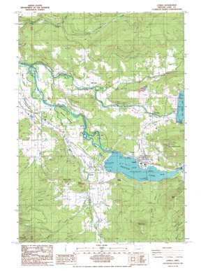
Lowell Topo Map Oregon
To zoom in, hover over the map of Lowell
USGS Topo Quad 43122h7 - 1:24,000 scale
| Topo Map Name: | Lowell |
| USGS Topo Quad ID: | 43122h7 |
| Print Size: | ca. 21 1/4" wide x 27" high |
| Southeast Coordinates: | 43.875° N latitude / 122.75° W longitude |
| Map Center Coordinates: | 43.9375° N latitude / 122.8125° W longitude |
| U.S. State: | OR |
| Filename: | o43122h7.jpg |
| Download Map JPG Image: | Lowell topo map 1:24,000 scale |
| Map Type: | Topographic |
| Topo Series: | 7.5´ |
| Map Scale: | 1:24,000 |
| Source of Map Images: | United States Geological Survey (USGS) |
| Alternate Map Versions: |
Lowell OR 1986, updated 1986 Download PDF Buy paper map Lowell OR 2011 Download PDF Buy paper map Lowell OR 2014 Download PDF Buy paper map |
1:24,000 Topo Quads surrounding Lowell
> Back to 43122e1 at 1:100,000 scale
> Back to 43122a1 at 1:250,000 scale
> Back to U.S. Topo Maps home
Lowell topo map: Gazetteer
Lowell: Bridges
Lowell Covered Bridge elevation 214m 702′Pengra Covered Bridge elevation 179m 587′
Unity Covered Bridge elevation 208m 682′
Lowell: Dams
Dexter Dam elevation 197m 646′Fall Creek Dam elevation 220m 721′
Lookout Point Dam elevation 241m 790′
Lowell: Parks
Dexter State Park elevation 217m 711′Elijah Bristow State Park elevation 196m 643′
Fall Creek County Park elevation 205m 672′
Lowell State Park elevation 218m 715′
Lowell: Pillars
Eagle Rock elevation 690m 2263′Lowell: Populated Places
Dexter elevation 204m 669′Fall Creek elevation 191m 626′
Lowell elevation 224m 734′
Trent elevation 189m 620′
Unity elevation 234m 767′
Lowell: Post Offices
Dexter Post Office elevation 204m 669′Fall Creek Post Office elevation 191m 626′
Lowell Post Office elevation 224m 734′
Pengra Post Office (historical) elevation 196m 643′
Trent Post Office (historical) elevation 189m 620′
Zion Post Office (historical) elevation 226m 741′
Lowell: Reservoirs
Dexter Reservoir elevation 196m 643′Fall Creek Lake elevation 227m 744′
Green Reservoir elevation 179m 587′
Lookout Point Lake elevation 252m 826′
Lowell: Streams
Anthony Creek elevation 218m 715′Castle Creek elevation 230m 754′
Cedar Creek elevation 236m 774′
Dexter Creek elevation 284m 931′
Fall Creek elevation 171m 561′
Little Fall Creek elevation 189m 620′
Lost Creek elevation 184m 603′
Noisy Creek elevation 214m 702′
Small Creek elevation 183m 600′
Wagner Creek elevation 216m 708′
Lowell: Summits
Butte Disappointment elevation 648m 2125′Jacoby Mountain elevation 356m 1167′
Mount Zion elevation 796m 2611′
Parvin Butte elevation 354m 1161′
Pengra Mountain elevation 297m 974′
Williams Butte elevation 372m 1220′
Lowell digital topo map on disk
Buy this Lowell topo map showing relief, roads, GPS coordinates and other geographical features, as a high-resolution digital map file on DVD:


