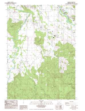
Jasper Topo Map Oregon
To zoom in, hover over the map of Jasper
USGS Topo Quad 43122h8 - 1:24,000 scale
| Topo Map Name: | Jasper |
| USGS Topo Quad ID: | 43122h8 |
| Print Size: | ca. 21 1/4" wide x 27" high |
| Southeast Coordinates: | 43.875° N latitude / 122.875° W longitude |
| Map Center Coordinates: | 43.9375° N latitude / 122.9375° W longitude |
| U.S. State: | OR |
| Filename: | o43122h8.jpg |
| Download Map JPG Image: | Jasper topo map 1:24,000 scale |
| Map Type: | Topographic |
| Topo Series: | 7.5´ |
| Map Scale: | 1:24,000 |
| Source of Map Images: | United States Geological Survey (USGS) |
| Alternate Map Versions: |
Jasper OR 1986, updated 1986 Download PDF Buy paper map Jasper OR 2011 Download PDF Buy paper map Jasper OR 2014 Download PDF Buy paper map |
1:24,000 Topo Quads surrounding Jasper
> Back to 43122e1 at 1:100,000 scale
> Back to 43122a1 at 1:250,000 scale
> Back to U.S. Topo Maps home
Jasper topo map: Gazetteer
Jasper: Parks
Jasper State Park elevation 168m 551′Jasper: Populated Places
Cloverdale elevation 170m 557′Jasper elevation 163m 534′
Pleasant Hill elevation 199m 652′
Jasper: Post Offices
Jasper Post Office elevation 163m 534′Pleasant Hill Post Office elevation 199m 652′
Jasper: Reservoirs
Derr Pond elevation 161m 528′Robberson Reservoir elevation 195m 639′
Jasper: Streams
Alder Creek elevation 170m 557′Bear Creek elevation 151m 495′
Camas Swale Creek elevation 152m 498′
Hill Creek elevation 157m 515′
Hills Creek elevation 163m 534′
Papenfus Creek elevation 146m 479′
Rattlesnake Creek elevation 169m 554′
Wild Hog Creek elevation 147m 482′
Jasper: Summits
Rattlesnake Butte elevation 386m 1266′Round Mountain elevation 654m 2145′
Sellers Butte elevation 318m 1043′
Short Mountain elevation 336m 1102′
Jasper digital topo map on disk
Buy this Jasper topo map showing relief, roads, GPS coordinates and other geographical features, as a high-resolution digital map file on DVD:


