Kenyon Mountain Topo Map Oregon
To zoom in, hover over the map of Kenyon Mountain
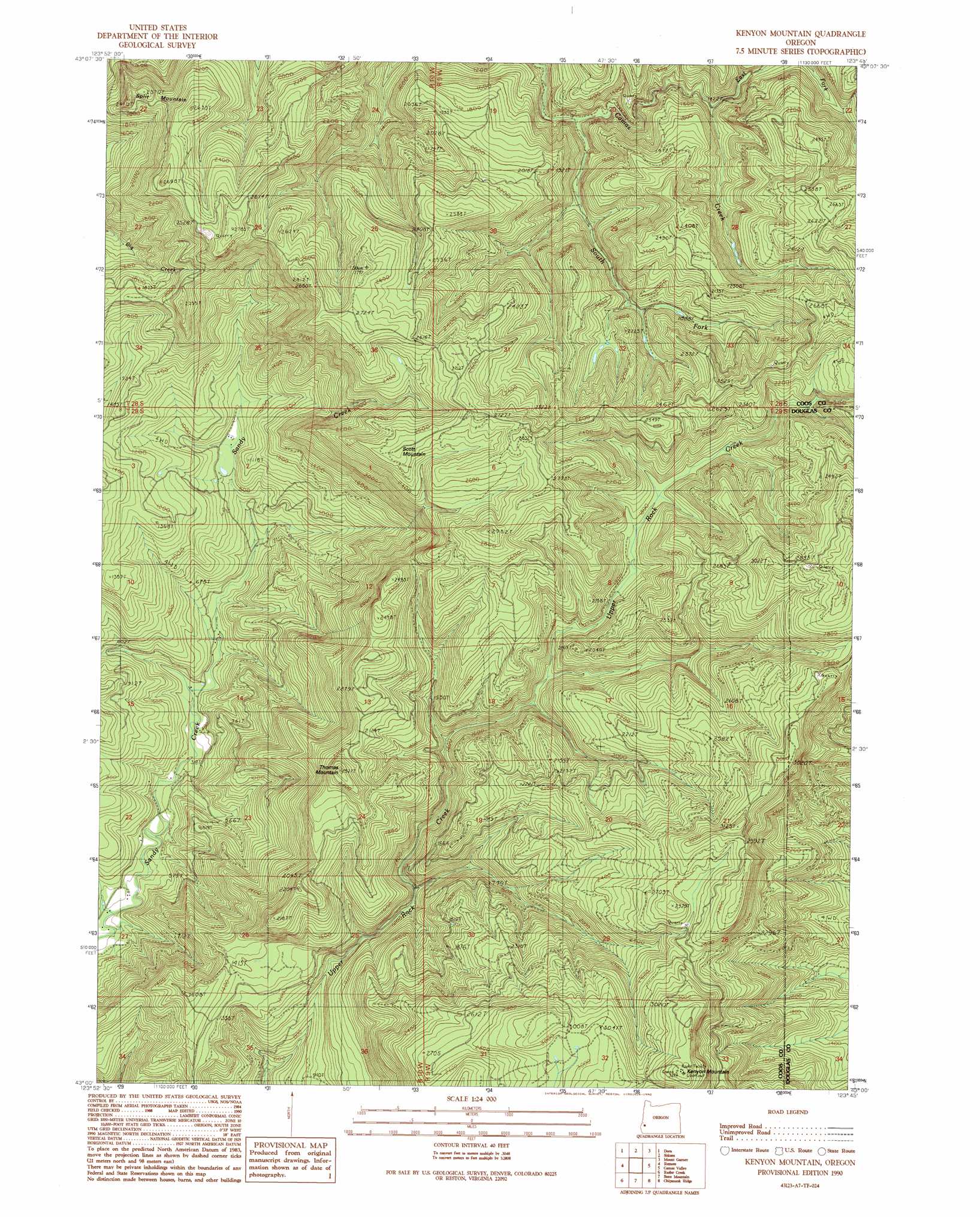
USGS Topo Quad 43123a7 - 1:24,000 scale
| Topo Map Name: | Kenyon Mountain |
| USGS Topo Quad ID: | 43123a7 |
| Print Size: | ca. 21 1/4" wide x 27" high |
| Southeast Coordinates: | 43° N latitude / 123.75° W longitude |
| Map Center Coordinates: | 43.0625° N latitude / 123.8125° W longitude |
| U.S. State: | OR |
| Filename: | o43123a7.jpg |
| Download Map JPG Image: | Kenyon Mountain topo map 1:24,000 scale |
| Map Type: | Topographic |
| Topo Series: | 7.5´ |
| Map Scale: | 1:24,000 |
| Source of Map Images: | United States Geological Survey (USGS) |
| Alternate Map Versions: |
Kenyon Mountain OR 1990, updated 1990 Download PDF Buy paper map Kenyon Mountain OR 2011 Download PDF Buy paper map Kenyon Mountain OR 2014 Download PDF Buy paper map |
1:24,000 Topo Quads surrounding Kenyon Mountain
Daniels Creek |
Coos Mountain |
Tioga |
Cedar Creek |
Callahan |
Mckinley |
Dora |
Sitkum |
Mount Gurney |
Reston |
Bridge |
Remote |
Kenyon Mountain |
Camas Valley |
Tenmile |
Powers |
Rasler Creek |
Bone Mountain |
Chipmunk Ridge |
Live Oak Mountain |
China Flat |
Eden Ridge Valley |
Mount Bolivar |
Dutchman Butte |
Rabbit Mountain |
> Back to 43123a1 at 1:100,000 scale
> Back to 43122a1 at 1:250,000 scale
> Back to U.S. Topo Maps home
Kenyon Mountain topo map: Gazetteer
Kenyon Mountain: Streams
East Fork Camas Creek elevation 430m 1410′South Fork Camas Creek elevation 348m 1141′
Kenyon Mountain: Summits
Kenyon Mountain elevation 1006m 3300′Scott Mountain elevation 821m 2693′
Split Mountain elevation 704m 2309′
Thomas Mountain elevation 772m 2532′
Kenyon Mountain digital topo map on disk
Buy this Kenyon Mountain topo map showing relief, roads, GPS coordinates and other geographical features, as a high-resolution digital map file on DVD: