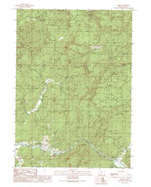
Remote Topo Map Oregon
To zoom in, hover over the map of Remote
USGS Topo Quad 43123a8 - 1:24,000 scale
| Topo Map Name: | Remote |
| USGS Topo Quad ID: | 43123a8 |
| Print Size: | ca. 21 1/4" wide x 27" high |
| Southeast Coordinates: | 43° N latitude / 123.875° W longitude |
| Map Center Coordinates: | 43.0625° N latitude / 123.9375° W longitude |
| U.S. State: | OR |
| Filename: | o43123a8.jpg |
| Download Map JPG Image: | Remote topo map 1:24,000 scale |
| Map Type: | Topographic |
| Topo Series: | 7.5´ |
| Map Scale: | 1:24,000 |
| Source of Map Images: | United States Geological Survey (USGS) |
| Alternate Map Versions: |
Remote OR 1990, updated 1990 Download PDF Buy paper map Remote OR 2011 Download PDF Buy paper map Remote OR 2014 Download PDF Buy paper map |
1:24,000 Topo Quads surrounding Remote
> Back to 43123a1 at 1:100,000 scale
> Back to 43122a1 at 1:250,000 scale
> Back to U.S. Topo Maps home
Remote topo map: Gazetteer
Remote: Areas
Enchanted Prairie elevation 61m 200′Remote: Bridges
Remote Bridge elevation 69m 226′Remote: Parks
Sandy Creek Covered Bridge elevation 73m 239′Remote: Populated Places
Remote elevation 75m 246′Remote: Post Offices
Remote Post Office elevation 75m 246′Remote: Streams
Axe Creek elevation 79m 259′Bear Pan Creek elevation 175m 574′
Bear Pen Creek elevation 77m 252′
Belieu Creek elevation 38m 124′
Brownson Creek elevation 73m 239′
Fall Creek elevation 43m 141′
Fetter Creek elevation 139m 456′
Frenchie Creek elevation 53m 173′
Myrtle Creek elevation 34m 111′
Sandy Creek elevation 66m 216′
Slide Creek elevation 68m 223′
South Fork Elk Creek elevation 44m 144′
Tanner Creek elevation 52m 170′
Remote digital topo map on disk
Buy this Remote topo map showing relief, roads, GPS coordinates and other geographical features, as a high-resolution digital map file on DVD:


